Data
- Obtaining
- Supplying
- High-Frequency
- Bottom Pressure Records
- Other Long Records
- GLOSS/ODINAFRICA Calibration Data
Donate
Donate to PSMSL
Data Notes
- Individual Station Data and Plot Notes
- Referencing the Data Set
- PSMSL Help File
- 2010 Changes to the PSMSL Data Files
Extracted from Database
09 Feb 2026
Station Information
| Station ID: | 938 |
| Latitude: | -4.783333 |
| Longitude: | 11.833333 |
| GLOSS ID: | 261 |
| Coastline code: | 424 |
| Station code: | 21 |
| Country: | CONGO |
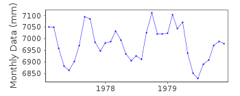
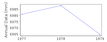
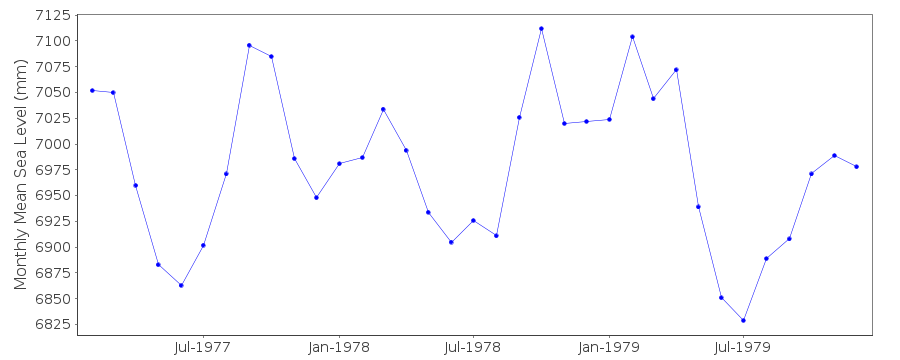
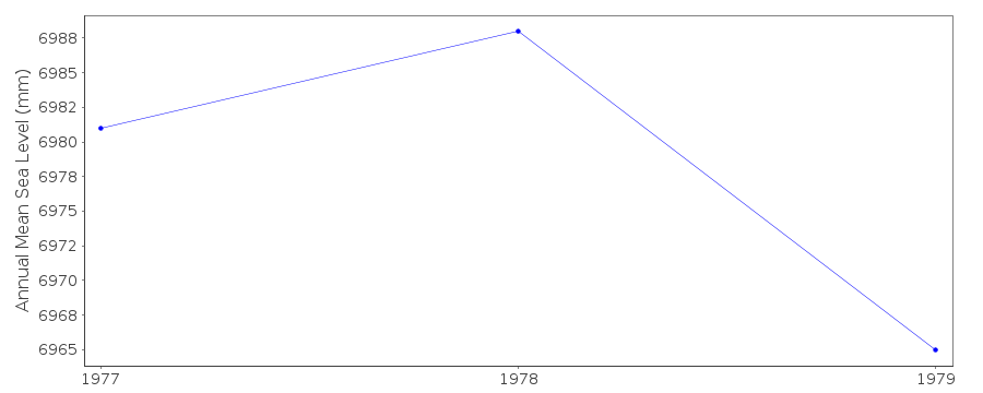
| Time span of RLR data: | 1977 – 1979 |
| RLR completeness (%): | 97 |
| Time span of metric data: | 1959 – 1988 |
| Metric completeness (%): | 38 |
| Date of last update: | 25 Nov 1993 |
| Green Arrow: | Current Station |
| Yellow Marker: | Neighbouring RLR Station |
| Red Marker: | Neighbouring Metric Station |
Please note: In many cases, the station position in our database is accurate to only one minute. Thus, the tide gauge may not appear to be on the coast.
Tide Gauge Data
Additional Data Sources (guide to additional data sources)
Fast Delivery Data from UHSLC station 234: hourly and dailyResearch Quality Data from UHSLC station 234: hourly and daily
Station Documentation
Link to RLR information.Documentation added 1991-06-11
Pointe Noire 424/021 RLR(1979) is 9.6m below Repere B1Documentation added 1993-07-12
Pointe Noire 424/021 RLR(1979) is 9.6m below Repere B1Documentation added 1993-11-12
data 1980-83 and 1988 received from TOGA officeDocumentation added 1993-11-12
data for 1959-60 and 1977-79 received from authority 18Data Authority
O.R.S.T.O.M.BP 1286
Pointe Noire

![]()
![]()
![]()
