Data
- Obtaining
- Supplying
- High-Frequency
- Bottom Pressure Records
- Other Long Records
- GLOSS/ODINAFRICA Calibration Data
Donate
Donate to PSMSL
Data Notes
- Individual Station Data and Plot Notes
- Referencing the Data Set
- PSMSL Help File
- 2010 Changes to the PSMSL Data Files
Extracted from Database
08 Dec 2025
Station Information
| Station ID: | 803 |
| Latitude: | 65.483333 |
| Longitude: | 12.216667 |
| Coastline code: | 40 |
| Station code: | 131 |
| Country: | NORWAY |
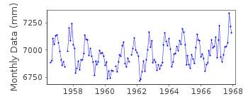
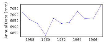
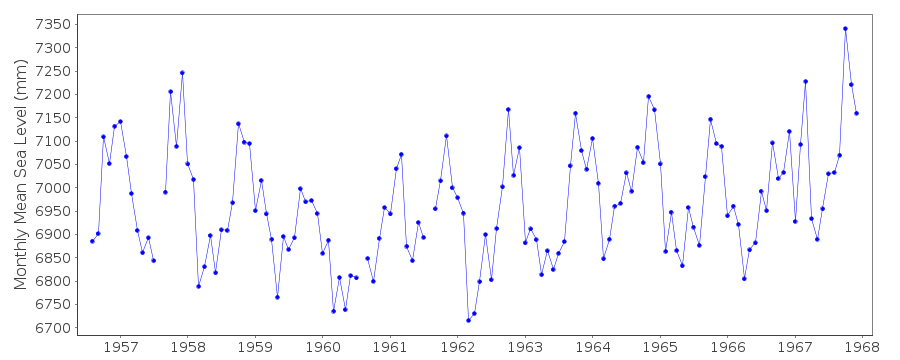
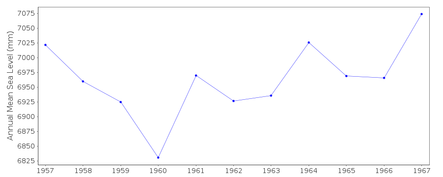
| Time span of data: | 1956 – 1967 |
| Completeness (%): | 93 |
| Date of last update: | 01 Jan 1980 |
| Green Arrow: | Current Station |
| Yellow Marker: | Neighbouring RLR Station |
| Red Marker: | Neighbouring Metric Station |
Please note: In many cases, the station position in our database is accurate to only one minute. Thus, the tide gauge may not appear to be on the coast.
Tide Gauge Data
Station Documentation
Link to RLR information.Documentation added 1991-06-11
Bronnoysund 040/131 RLR(1964) is 9.8m below BM KaiBronnoysund is an historic station. Last data 1967
Data Authority
Norwegian Mapping AuthorityHydrographic Service
Po. Box 60
4001 Stavanger

![]()
![]()
![]()
