Data
- Obtaining
- Supplying
- High-Frequency
- Bottom Pressure Records
- Other Long Records
- GLOSS/ODINAFRICA Calibration Data
Donate
Donate to PSMSL
Data Notes
- Individual Station Data and Plot Notes
- Referencing the Data Set
- PSMSL Help File
- 2010 Changes to the PSMSL Data Files
Extracted from Database
21 Jul 2025
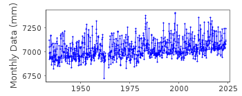
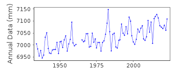
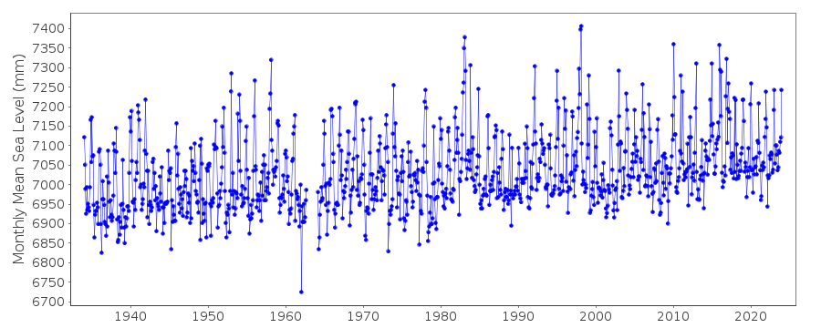
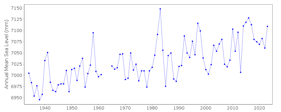
Station Information
| Station ID: | 384 |
| Latitude: | 48.546667 |
| Longitude: | -123.01 |
| Coastline code: | 823 |
| Station code: | 6 |
| Country: | UNITED STATES |
| Time span of data: | 1934 – 2024 |
| Completeness (%): | 98 |
| Date of last update: | 23 Jan 2025 |
| Green Arrow: | Current Station |
| Yellow Marker: | Neighbouring RLR Station |
| Red Marker: | Neighbouring Metric Station |
Please note: In many cases, the station position in our database is accurate to only one minute. Thus, the tide gauge may not appear to be on the coast.
Tide Gauge Data
Station Documentation
Link to RLR information.Documentation added 1991-06-11
Friday Harbor 823/006 RLR(1971) is 11.3m below BM 2 1932Documentation added 1993-07-29
Anomalously low value in January 1962 - correct as received from authority. Flags on 1962 data have been removed as the data agrees with the NOAA website.Documentation added 2011-10-12
Using NOAA information the RLR diagram has been revised. Former Primary benchmark 2 1932 6.815m above gauge datum appears in the NOAA report of 1988 but not in the report of 2003. Current Primary benchmark NO 10 1964 4.892m above gauge datum appears on the original RLR diagram as being the reference benchmark from 1975 onwards.Data Authority
N.O.A.A. / N.O.S.N/oes33, Ssmc4, Room 6531
1305 East-West Highway
Silver Spring,
MD 20910

![]()
![]()
![]()
