Data
- Obtaining
- Supplying
- High-Frequency
- Bottom Pressure Records
- Other Long Records
- GLOSS/ODINAFRICA Calibration Data
Donate
Donate to PSMSL
Data Notes
- Individual Station Data and Plot Notes
- Referencing the Data Set
- PSMSL Help File
- 2010 Changes to the PSMSL Data Files
Extracted from Database
21 Jul 2025
Station Information
| Station ID: | 330 |
| Latitude: | 55.522222 |
| Longitude: | 12.893611 |
| Coastline code: | 50 |
| Station code: | 51 |
| Country: | SWEDEN |
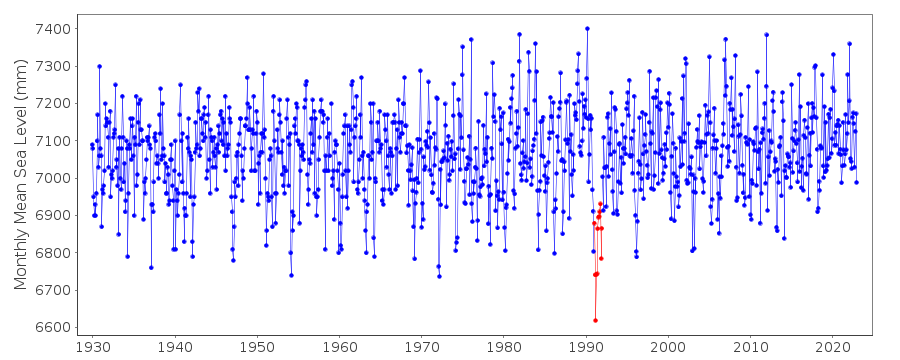
| Time span of data: | 1929 – 2024 |
| Completeness (%): | 99 |
| Date of last update: | 27 May 2025 |
| Green Arrow: | Current Station |
| Yellow Marker: | Neighbouring RLR Station |
| Red Marker: | Neighbouring Metric Station |
Please note: In many cases, the station position in our database is accurate to only one minute. Thus, the tide gauge may not appear to be on the coast.
Tide Gauge Data
Additional Data Sources (guide to additional data sources)
Nearby Real Time Stations from VLIZ: klagStation Documentation
Link to RLR information.Documentation - date unknown
1929 - 1937 MSL VALUES BASED UPON INTEGRATION OF CONTINUOUS RECORDDocumentation added 1991-06-11
Klagshamn 050/051 RLR(1964) is 10.5m below BM No Fix dDocumentation added 1994-10-19
data for 1987-90 revised in October 1994Documentation added 2006-11-28
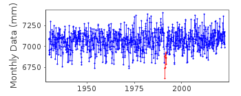
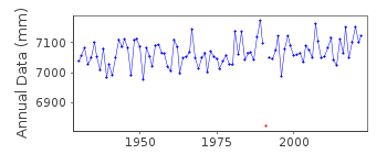
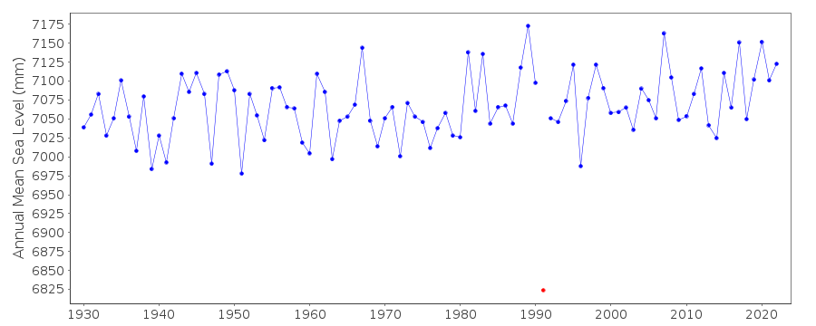
1991 data flagged because of large spike within the data.Documentation added 2009-02-09
relationship to the Swedish Height System 1900 has been adjustedfor this station. Previous value was 197.3 revised value is 199.2
As a result RLRFAC adjusted to 4831.
Documentation added 2010-05-19
Data for 1937-2008 given to 220cm below Swedish Height System 1900 (RH00)Data for 2009 onward given to local datum 799.2cm below RH00
Documentation added 2010-06-09
Because of the change in reference datum the RLR value is now -961mm.Data Authority
Swedish Met. and Hyd. InstituteBox 923
S601 76 Norrkoping

![]()
![]()
![]()
