Data
- Obtaining
- Supplying
- High-Frequency
- Bottom Pressure Records
- Other Long Records
- GLOSS/ODINAFRICA Calibration Data
Donate
Donate to PSMSL
Data Notes
- Individual Station Data and Plot Notes
- Referencing the Data Set
- PSMSL Help File
- 2010 Changes to the PSMSL Data Files
Extracted from Database
13 Jul 2026
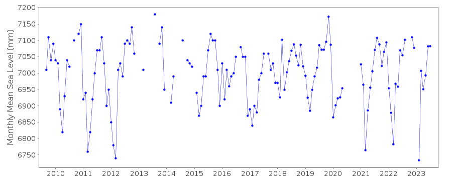
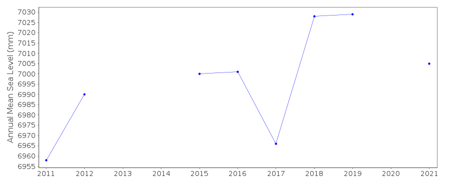
Station Information
| Station ID: | 2165 |
| Latitude: | 35.348475 |
| Longitude: | 25.152692 |
| Coastline code: | 290 |
| Station code: | 102 |
| Country: | GREECE |
| Time span of data: | 2009 – 2025 |
| Completeness (%): | 79 |
| Date of last update: | 13 Mar 2026 |
| Green Arrow: | Current Station |
| Yellow Marker: | Neighbouring RLR Station |
| Red Marker: | Neighbouring Metric Station |
Please note: In many cases, the station position in our database is accurate to only one minute. Thus, the tide gauge may not appear to be on the coast.
Tide Gauge Data
Station Documentation
Link to RLR information.Documentation added 2013-03-14
Greek station Iraklion was moved in September 2009. The zero level was set12cm below the previous one. Primary benchmark is R 10 4.77m above TGZ.
RLR factor is 6.33m. The station is now named Iraklion II
Data Authority
Hellenic Navy Hydrographic ServiceGeographic Policy and International Relations Office
TGN 1040
Athens

![]()
![]()
![]()
