Data
- Obtaining
- Supplying
- High-Frequency
- Bottom Pressure Records
- Other Long Records
- GLOSS/ODINAFRICA Calibration Data
Donate
Donate to PSMSL
Data Notes
- Individual Station Data and Plot Notes
- Referencing the Data Set
- PSMSL Help File
- 2010 Changes to the PSMSL Data Files
Extracted from Database
22 Jun 2026
Station Information
| Station ID: | 2116 |
| Latitude: | 12.583333 |
| Longitude: | -81.7 |
| Coastline code: | 902 |
| Station code: | 1 |
| Country: | COLOMBIA |
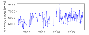
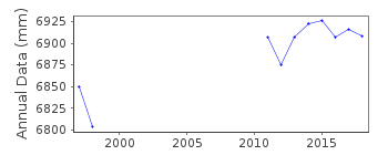
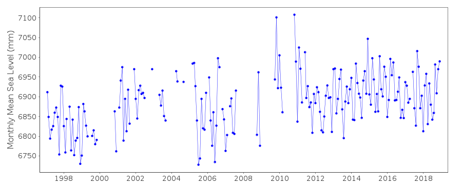
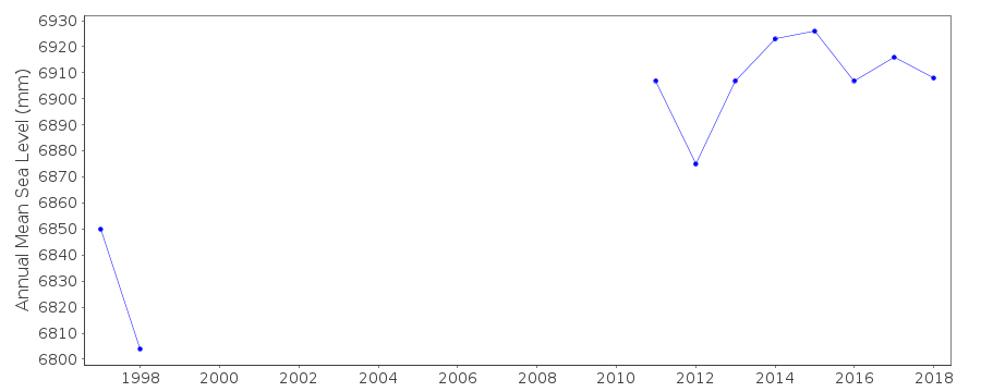
| Time span of data: | 1997 – 2018 |
| Completeness (%): | 72 |
| Date of last update: | 07 Mar 2023 |
| Green Arrow: | Current Station |
| Yellow Marker: | Neighbouring RLR Station |
| Red Marker: | Neighbouring Metric Station |
Please note: In many cases, the station position in our database is accurate to only one minute. Thus, the tide gauge may not appear to be on the coast.
Tide Gauge Data
Additional Data Sources (guide to additional data sources)
Nearby GNSS Stations from SONEL: SAN0Nearby Real Time Stations from VLIZ: sana
Fast Delivery Data from UHSLC station 737: hourly and daily
Research Quality Data from UHSLC station 737: hourly and daily
Station Documentation
Link to RLR information.Documentation added 2012-01-18
This is a new station. Data was downloaded from the latest copy of the UHSLC JASL cd.Documentation added 2015-10-21
From the latest JASL data the complete dataset 1997-2014 has been loaded onto the database. There are several additional data points included.Data Authority
University of Hawaii Sea Level CenterDepartment of Oceanography Division of Natural Sciences
1000 Pope Road
Honolulu
Hawaii 96822

![]()
![]()
![]()
