Data
- Obtaining
- Supplying
- High-Frequency
- Bottom Pressure Records
- Other Long Records
- GLOSS/ODINAFRICA Calibration Data
Donate
Donate to PSMSL
Data Notes
- Individual Station Data and Plot Notes
- Referencing the Data Set
- PSMSL Help File
- 2010 Changes to the PSMSL Data Files
Extracted from Database
06 Apr 2026
Station Information
| Station ID: | 2062 |
| Latitude: | 39.89304 |
| Longitude: | 4.27056 |
| Coastline code: | 225 |
| Station code: | 16 |
| Country: | SPAIN |
| Time span of data: | 2009 – 2024 |
| Completeness (%): | 93 |
| Date of last update: | 03 Jul 2025 |
| Green Arrow: | Current Station |
| Yellow Marker: | Neighbouring RLR Station |
| Red Marker: | Neighbouring Metric Station |
Please note: In many cases, the station position in our database is accurate to only one minute. Thus, the tide gauge may not appear to be on the coast.
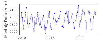
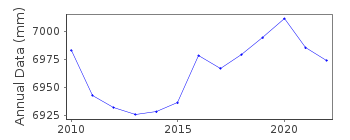
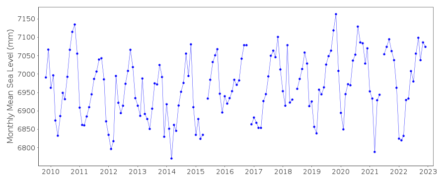
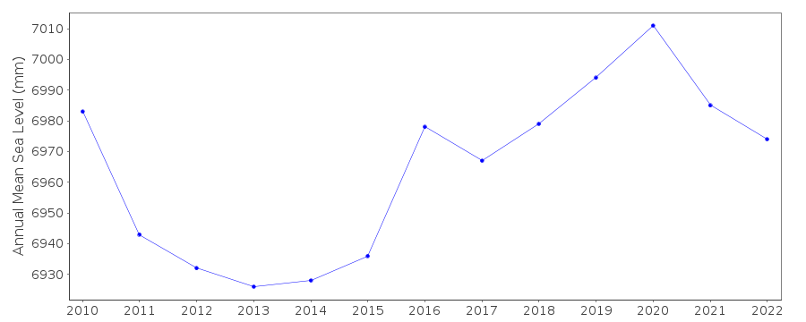
Tide Gauge Data
Additional Data Sources (guide to additional data sources)
Nearby GNSS Stations from SONEL: ALORNearby Real Time Stations from VLIZ: maho
Station Documentation
Link to RLR information.Documentation added 2011-01-24
Mahon is on the island of Minorca and is a new station first data 2009 andforms part of the newly established REDMAR network. Gauge is a MIROS radar sensor.
Benchmark NGAB MAREOG-MAO is 1.219m relative to the REDMAR datum and 1.336m
relative to IGN. See paper B. Perez et al 'Overlapping sea level time series
measured using different technologies: an example from the REDMAR Spanish network'.
Documentation added 2014-04-29
At the request of Puertos del Estado the latitude and longitude have been revised from 39.891667 4.270000 as derived from a previously degrees and minutes value to 39.89304 4.27056 the site of the new MIROS gauge in decimal degrees.Data Authority
Puertos del EstadoÁrea de Conocimiento y Análisis del Medio Físico
Avda. Del Partenón, 10
28042, Madrid
Documentation added 2001-03-06
The Area de Conocimiento y Analisis del Medio Fisico wasformerly known as the Departamento de Clima Maritimo.

![]()
![]()
![]()
