Data
- Obtaining
- Supplying
- High-Frequency
- Bottom Pressure Records
- Other Long Records
- GLOSS/ODINAFRICA Calibration Data
Donate
Donate to PSMSL
Data Notes
- Individual Station Data and Plot Notes
- Referencing the Data Set
- PSMSL Help File
- 2010 Changes to the PSMSL Data Files
Extracted from Database
08 Dec 2025
Station Information
| Station ID: | 1574 |
| Latitude: | 43.066667 |
| Longitude: | 16.2 |
| Coastline code: | 280 |
| Station code: | 40 |
| Country: | CROATIA |
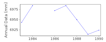
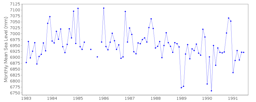
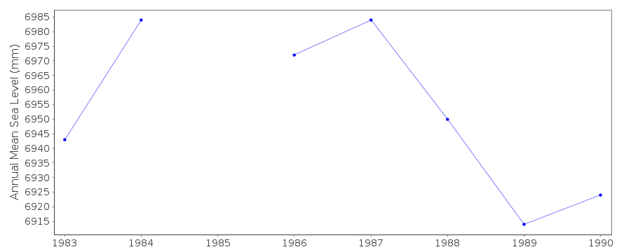
| Time span of data: | 1983 – 1991 |
| Completeness (%): | 90 |
| Date of last update: | 03 Feb 1993 |
| Green Arrow: | Current Station |
| Yellow Marker: | Neighbouring RLR Station |
| Red Marker: | Neighbouring Metric Station |
Please note: In many cases, the station position in our database is accurate to only one minute. Thus, the tide gauge may not appear to be on the coast.
Tide Gauge Data

Station Documentation
Link to RLR information.Documentation added 1991-06-11
Vis-Ceska Vila 280/040 RLR(1985) is 12.6m below BMDocumentation added 1993-07-12
Vis-Ceska Vila 280/040 RLR(1985) is 12.6m below BMDocumentation added 1996-01-12
gauge destroyed 30 June 1991Documentation added 1996-01-12
PRIOR TO 1990 DATA FROM AUTH 26Documentation added 2011-01-20
According to the original RLR diagram this gauge was destroyed in 1991.Data Authority
Hidrografski Institut of Rep. of CroatiaZrinsko-Frankopanska 161
21000 Split

![]()
![]()
![]()
