Data
- Obtaining
- Supplying
- High-Frequency
- Bottom Pressure Records
- Other Long Records
- GLOSS/ODINAFRICA Calibration Data
Donate
Donate to PSMSL
Data Notes
- Individual Station Data and Plot Notes
- Referencing the Data Set
- PSMSL Help File
- 2010 Changes to the PSMSL Data Files
Extracted from Database
06 Apr 2026
Station Information
| Station ID: | 1549 |
| Latitude: | -20.623611 |
| Longitude: | 116.749056 |
| Coastline code: | 680 |
| Station code: | 486 |
| Country: | AUSTRALIA |
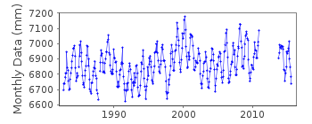
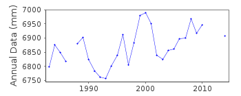
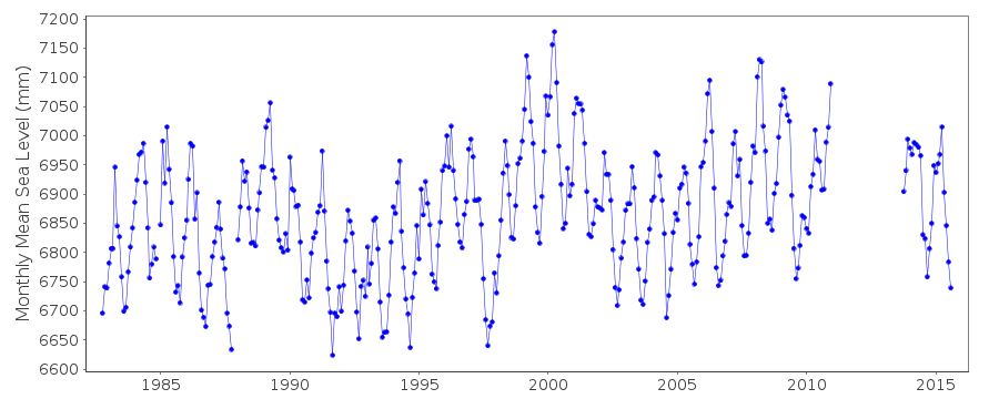
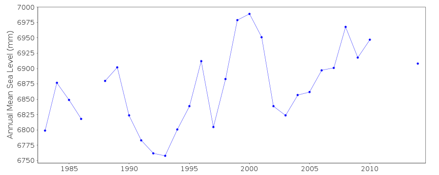
| Time span of data: | 1982 – 2015 |
| Completeness (%): | 88 |
| Date of last update: | 16 Mar 2020 |
| Green Arrow: | Current Station |
| Yellow Marker: | Neighbouring RLR Station |
| Red Marker: | Neighbouring Metric Station |
Please note: In many cases, the station position in our database is accurate to only one minute. Thus, the tide gauge may not appear to be on the coast.
Tide Gauge Data
Station Documentation
Link to RLR information.Documentation added 1995-05-02
Station density along some sections of the Australian coast has meant that station codes 601 onwards have been re-ordered compared to those in earlier versions of the PSMSL data set.Documentation added 1996-05-20
Revised data 1982-1986 received from the National Tidal Centre, Bureau of Meteorology, South AustraliaDocumentation added 2010-08-23
Supplying authority have confirmed that for data after 9/10/1982, vertical datum is Chart Datum. Primary benchmark A 958 is 7.477 m above Chart Datum. RLR (2008) defined as 11.6 m belowA 958
Documentation added 2013-03-14
The reference datum for King Bay changed from Chart Datum to Lowest Astronomical Tide (LAT) on 01/01/2009. The difference between the two is 0.12m the RLR factor has changed.Documentation added 2013-08-19
Following a recent download of data for King Bay from the NTC website it was noticed that the data for 2008 had been revised. This data has now been re-loaded onto the database.Documentation added 2020-03-16
A comparison of data with that currently available from the Bureau of Meteorology shows the switch in datum to LAT occurred at the start of 2008, not 2009 (hence the correction of 2008 data made in 2013).Data Authority
National Tidal CentreBureau of Meteorology
PO Box 421
Kent Town 5071
South Australia
Documentation added 2010-08-12
Formerly known as the National Tidal Facility

![]()
![]()
![]()
