Data
- Obtaining
- Supplying
- High-Frequency
- Bottom Pressure Records
- Other Long Records
- GLOSS/ODINAFRICA Calibration Data
Donate
Donate to PSMSL
Data Notes
- Individual Station Data and Plot Notes
- Referencing the Data Set
- PSMSL Help File
- 2010 Changes to the PSMSL Data Files
Extracted from Database
21 Jul 2025
Station Information
| Station ID: | 139 |
| Latitude: | 43.283333 |
| Longitude: | 145.583333 |
| Coastline code: | 641 |
| Station code: | 11 |
| Country: | JAPAN |
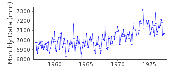
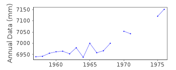
| Time span of RLR data: | 1957 – 1977 |
| RLR completeness (%): | 91 |
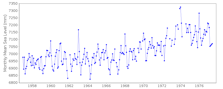
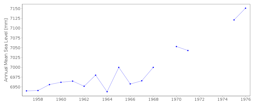
| Time span of metric data: | 1900 – 1977 |
| Metric completeness (%): | 79 |
| Date of last update: | 01 Jan 1980 |
| Green Arrow: | Current Station |
| Yellow Marker: | Neighbouring RLR Station |
| Red Marker: | Neighbouring Metric Station |
Please note: In many cases, the station position in our database is accurate to only one minute. Thus, the tide gauge may not appear to be on the coast.
Tide Gauge Data
Additional Data Sources (guide to additional data sources)
Nearby Real Time Stations from VLIZ: hanaStation Documentation
Link to RLR information.Documentation - date unknown
Station moved - new data held in station 641/012Documentation added 1991-06-11
Hanasaki 641/011 RLR(1966) is 8.8m below Attached BM A10Documentation added 1995-08-29
A destructive earthquake and tsunami occurred in the Kuril Islands on 4 October 1994 - see Earth System Monitor, 5(4), June 1995.Documentation added 2002-03-26
Hanasaki ceased operating 1977 and was replaced by Hanasaki II (641/012) 1st July 1977.Data Authority
Japan Meteorological Agency3-6-9 Toranomon, Minato City
Tokyo

![]()
![]()
![]()
