Data
- Obtaining
- Supplying
- High-Frequency
- Bottom Pressure Records
- Other Long Records
- GLOSS/ODINAFRICA Calibration Data
Donate
Donate to PSMSL
Data Notes
- Individual Station Data and Plot Notes
- Referencing the Data Set
- PSMSL Help File
- 2010 Changes to the PSMSL Data Files
Extracted from Database
26 Jan 2026
Station Information
| Station ID: | 1368 |
| Latitude: | -10.561667 |
| Longitude: | 142.151667 |
| Coastline code: | 680 |
| Station code: | 602 |
| Country: | AUSTRALIA |
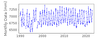
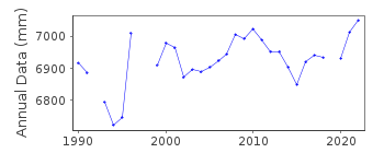
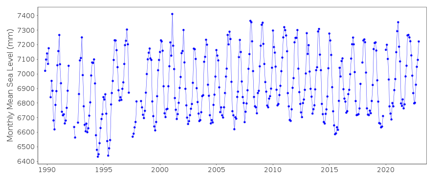
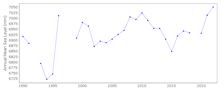
| Time span of RLR data: | 1989 – 2023 |
| RLR completeness (%): | 93 |
| Time span of metric data: | 1974 – 2023 |
| Metric completeness (%): | 68 |
| Date of last update: | 20 Mar 2025 |
| Green Arrow: | Current Station |
| Yellow Marker: | Neighbouring RLR Station |
| Red Marker: | Neighbouring Metric Station |
Please note: In many cases, the station position in our database is accurate to only one minute. Thus, the tide gauge may not appear to be on the coast.
Tide Gauge Data
Additional Data Sources (guide to additional data sources)
Nearby Real Time Stations from VLIZ: trstStation Documentation
Link to RLR information.Documentation added 1995-05-02
Station density along some sections of the Australian coast has meant that station codes 601 onwards have been re-ordered compared to those in earlier versions of the PSMSL data set.Documentation added 2010-08-23
Supplying authority have confirmed measurement datum from June 1986 is Chart Datum, and primary benchmark PSM 85838 is 7.026 m above Chart Datum RLR (2009) is defined as 11.8 m above PSM 85838Documentation added 2021-02-04
Last data available for download is that up to October 2019.Data Authority
National Tidal CentreBureau of Meteorology
PO Box 421
Kent Town 5071
South Australia
Documentation added 2010-08-12
Formerly known as the National Tidal Facility

![]()
![]()
![]()
