Data
- Obtaining
- Supplying
- High-Frequency
- Bottom Pressure Records
- Other Long Records
- GLOSS/ODINAFRICA Calibration Data
Donate
Donate to PSMSL
Data Notes
- Individual Station Data and Plot Notes
- Referencing the Data Set
- PSMSL Help File
- 2010 Changes to the PSMSL Data Files
Extracted from Database
26 Jan 2026
WARNING: QCFLAG EXISTS. PLEASE READ THE DOCUMENTATION.
Station Information
| Station ID: | 1250 |
| Latitude: | 38.416667 |
| Longitude: | 21.728694 |
| Coastline code: | 290 |
| Station code: | 14 |
| Country: | GREECE |
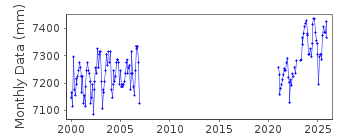
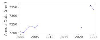
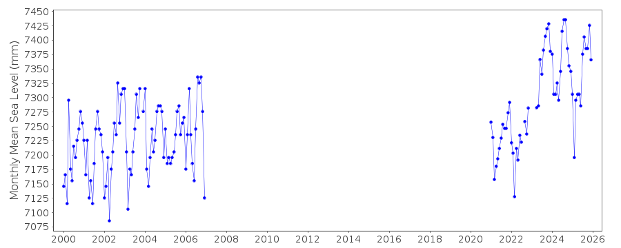
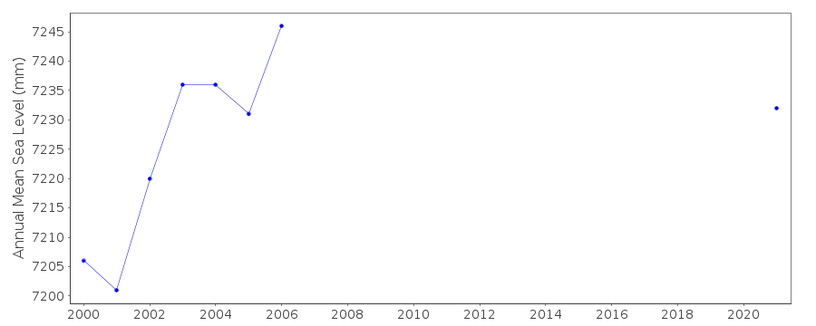
| Time span of RLR data: | 2000 – 2024 |
| RLR completeness (%): | 42 |
| Time span of metric data: | 1969 – 2024 |
| Metric completeness (%): | 65 |
| Date of last update: | 16 Apr 2025 |
| Green Arrow: | Current Station |
| Yellow Marker: | Neighbouring RLR Station |
| Red Marker: | Neighbouring Metric Station |
Please note: In many cases, the station position in our database is accurate to only one minute. Thus, the tide gauge may not appear to be on the coast.
Tide Gauge Data
Station Documentation
Link to RLR information.Documentation - date unknown
1969-75 Data from readings of tide poleDocumentation added 1991-06-11
Patrai 290/014 RLR(1981) is 9.9m below BM R78Documentation added 1997-03-11
The contributing authority advises that anomalous values are the result of met. influencesDocumentation added 2006-11-28
Whole dataset flagged due to datum query unresolved.Documentation added 2013-03-14
Following receipt of datum diagrams from the Hellenic Navy the RLR diagram has been re-drawn. In consequence the RLR factors have changed.Patrai tide gauge was moved in May 2011. This station has been superceded by Patrai II id. 2166Data Authority
Hellenic Navy Hydrographic ServiceGeographic Policy and International Relations Office
TGN 1040
Athens

![]()
![]()
![]()
