Data
- Obtaining
- Supplying
- High-Frequency
- Bottom Pressure Records
- Other Long Records
- GLOSS/ODINAFRICA Calibration Data
Donate
Donate to PSMSL
Data Notes
- Individual Station Data and Plot Notes
- Referencing the Data Set
- PSMSL Help File
- 2010 Changes to the PSMSL Data Files
Extracted from Database
11 Mar 2024
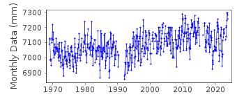
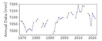
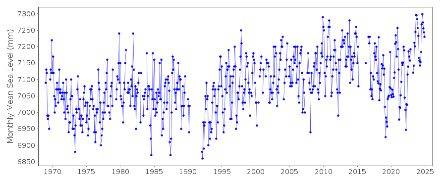
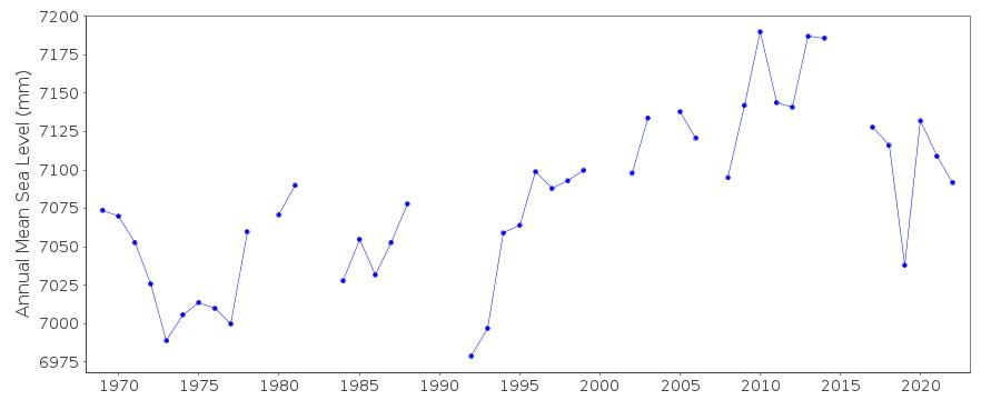
Station Information
| Station ID: | 1240 |
| Latitude: | 37.644822 |
| Longitude: | 21.319681 |
| Coastline code: | 290 |
| Station code: | 17 |
| Country: | GREECE |
| Time span of data: | 1969 – 2023 |
| Completeness (%): | 88 |
| Date of last update: | 20 Feb 2024 |
| Green Arrow: | Current Station |
| Yellow Marker: | Neighbouring RLR Station |
| Red Marker: | Neighbouring Metric Station |
Please note: In many cases, the station position in our database is accurate to only one minute. Thus, the tide gauge may not appear to be on the coast.
Tide Gauge Data
Additional Data Sources (guide to additional data sources)
Nearby GNSS Stations from SONEL: PYRGNearby Real Time Stations from VLIZ: kata
Station Documentation
Link to RLR information.Documentation - date unknown
1969-79(OCT) Data from readings of tide poleDocumentation added 1991-06-11
Katakolon 290/017 RLR(1977) is 9.6m below BM R11Documentation added 1993-07-12
Katakolon 290/017 RLR(1977) is 9.6m below BM R11Documentation added 1997-03-11
The contributing authority advises that anomalous valuesare the result of met. influences
Documentation added 2013-08-07
With the receipt of datum diagrams from the Hellenic Navy the RLR diagram has been re-drawn. As a consequence the RLR factors have changed.Data Authority
Hellenic Navy Hydrographic ServiceGeographic Policy and International Relations Office
TGN 1040
Athens

![]()
![]()
![]()
