Data
- Obtaining
- Supplying
- High-Frequency
- Bottom Pressure Records
- Other Long Records
- GLOSS/ODINAFRICA Calibration Data
Donate
Donate to PSMSL
Data Notes
- Individual Station Data and Plot Notes
- Referencing the Data Set
- PSMSL Help File
- 2010 Changes to the PSMSL Data Files
Extracted from Database
08 Dec 2025
Station Information
| Station ID: | 1057 |
| Latitude: | -39.866667 |
| Longitude: | -73.433333 |
| Coastline code: | 850 |
| Station code: | 47 |
| Country: | CHILE |
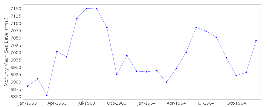
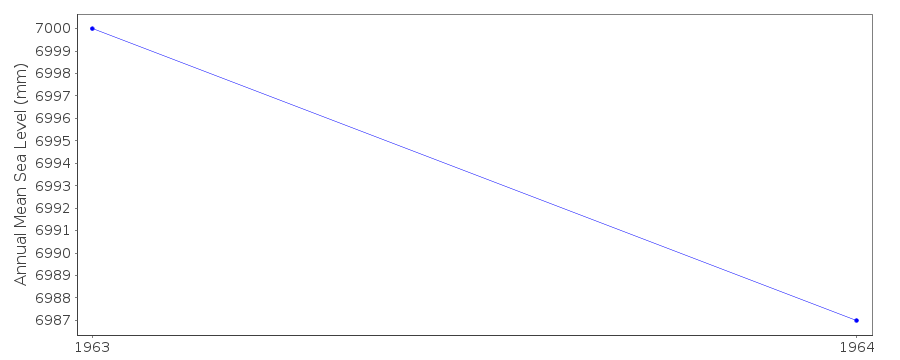
| Time span of data: | 1963 – 1964 |
| Completeness (%): | 100 |
| Date of last update: | 01 Jan 1980 |
| Green Arrow: | Current Station |
| Yellow Marker: | Neighbouring RLR Station |
| Red Marker: | Neighbouring Metric Station |
Please note: In many cases, the station position in our database is accurate to only one minute. Thus, the tide gauge may not appear to be on the coast.
Tide Gauge Data

Additional Data Sources (guide to additional data sources)
Nearby GNSS Stations from SONEL: NIEBNearby Real Time Stations from VLIZ: corr, corr2
Station Documentation
Link to RLR information.Documentation added 1993-07-12
Corral 850/047 RLR(1964) is 8.4m below BM(Cota Fija)3Documentation added 1996-01-03
There was a magnitude 7.8 earthquake about 20 km offshore of northern Chile on 30 July 1995 which produced a tsunami of 1.3 m at Caldera and which was seen in many records across the Pacific (information from NTF, Australia).Documentation added 2001-01-26
For a review of the new Chilean tide gauge network, see "Tides in the Chilean Coasts" by Juan J. Fierro, Hydro International,Jan/Feb 2001, pp.7-9.COASTLINE PRONE TO EARTHQUAKE ACTIVITY;DATA POSSIBLY AFFECTED AS A RESULT
Documentation added 2015-07-13
Previously this station was flagged following a review the station flag was removed. A permanent station was established at Corral in 1984 see id.2262.Data Authority
Hydrographic and Oceanographic Service of the Chilean NavyErrazuriz 254
Playa Ancha
Valparaiso

![]()
![]()
![]()
