Data
- Obtaining
- Supplying
- High-Frequency
- Bottom Pressure Records
- Other Long Records
- GLOSS/ODINAFRICA Calibration Data
Donate
Donate to PSMSL
Data Notes
- Individual Station Data and Plot Notes
- Referencing the Data Set
- PSMSL Help File
- 2010 Changes to the PSMSL Data Files
Extracted from Database
09 Feb 2026
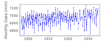
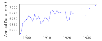
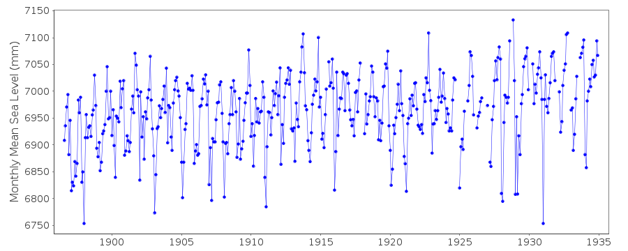
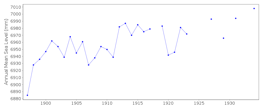
Station Information
| Station ID: | 104 |
| Latitude: | 39.2 |
| Longitude: | 9.166667 |
| Coastline code: | 240 |
| Station code: | 11 |
| Country: | ITALY |
| Time span of data: | 1896 – 1934 |
| Completeness (%): | 93 |
| Date of last update: | 01 Jan 1980 |
| Green Arrow: | Current Station |
| Yellow Marker: | Neighbouring RLR Station |
| Red Marker: | Neighbouring Metric Station |
Please note: In many cases, the station position in our database is accurate to only one minute. Thus, the tide gauge may not appear to be on the coast.
Tide Gauge Data
Additional Data Sources (guide to additional data sources)
Nearby GNSS Stations from SONEL: CAGL, UCAG, CAGZ, CAG1Nearby Real Time Stations from VLIZ: CA02
Station Documentation
Link to RLR information.Documentation - date unknown
NO BM INFORMATION BUT DATA SEEMS HOMOGENEOUSDocumentation added 1991-06-11
Cagliari 240/011 RLR(1934) is 7.9m above BMCagliari is an hitoric station. Last data 1934.
Data Authority
Istituto Idrografico della MarinaPasso Osservatorio 4
16134 Genova

![]()
![]()
![]()
