Data
- Obtaining
- Supplying
- High-Frequency
- Bottom Pressure Records
- Other Long Records
- GLOSS/ODINAFRICA Calibration Data
Donate
Donate to PSMSL
Data Notes
- Individual Station Data and Plot Notes
- Referencing the Data Set
- PSMSL Help File
- 2010 Changes to the PSMSL Data Files
Extracted from Database
13 Jul 2026
Station Information
| Station ID: | 978 |
| Latitude: | -37.63165 |
| Longitude: | 176.18495 |
| Coastline code: | 690 |
| Station code: | 4 |
| Country: | NEW ZEALAND |
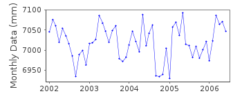
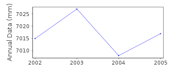
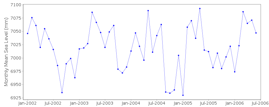
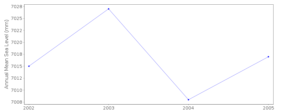
| Time span of RLR data: | 2002 – 2006 |
| RLR completeness (%): | 90 |
| Time span of metric data: | 1960 – 2006 |
| Metric completeness (%): | 12 |
| Date of last update: | 23 Nov 2010 |
| Green Arrow: | Current Station |
| Yellow Marker: | Neighbouring RLR Station |
| Red Marker: | Neighbouring Metric Station |
Please note: In many cases, the station position in our database is accurate to only one minute. Thus, the tide gauge may not appear to be on the coast.
Tide Gauge Data
Additional Data Sources (guide to additional data sources)
Nearby Real Time Stations from VLIZ: tautResearch Quality Data from UHSLC station 73: hourly and daily
Station Documentation
Link to RLR information.Documentation added 2003-01-17
New data from John Hannah added 17/01/03 which supercedes old data.New data does not have any missing days information.
Old data has been backed up.
Documentation added 2003-01-17
New data from John Hannah was for Auckland II, Dunedin II,Lyttelton II and Wellington II.
Documentation added 2005-10-17
There is a new John Hannah paper referring to New Zealand data forWellington, Dunedin, Lyttelton and Auckland. The reference is:
"An updated analysis of long-term sea level change in New Zealand."
Geophysical Research Letters, V31, L03307, doi:10.1029/2003GL019166
(2004).
Documentation added 2010-09-28
Data for Moturiki Jan2002-June2006 supplied by Glen Rowe LINZ 27.09.10. data ismetric so dataset added.
Documentation added 2010-11-23
Data for Moturiki Island 2002 onwards has been made RLR. Primary benchmark isBC 81 4.462m above TGZ. RLR year is 2002 with RLR factor 5.438m.
Data Authority
Department of Survey and Land InformationP.O. Box 170
Wellington

![]()
![]()
![]()
