Data
- Obtaining
- Supplying
- High-Frequency
- Bottom Pressure Records
- Other Long Records
- GLOSS/ODINAFRICA Calibration Data
Donate
Donate to PSMSL
Other Links
Data
Obtaining Tide Gauge Data:
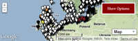

Obtain files and plots of individual stations via a map-based explorer or a table, or download the entire dataset
Supplying Tide Gauge Data:
Learn more about contributing data to PSMSLHigh Frequency Data:
Learn more about obtaining fast and delayed mode high frequency dataGNSS-IR Records: NEW!


Obtain files and plots of sea level data measured using GNSS receivers via a map-based explorer or a table, or read a guide on how to download the entire dataset
Bottom Pressure Records:
Obtain files and plots of bottom pressure data via a map-based explorer or a table, or download the entire datasetLong Records:
Use this page to obtain long time series that are not in PSMSL main data setGLOSS/ODINAFRICA Calibration Data:
Obtain calibration data for the ODINAFRICA sites

![]()
![]()
![]()
