Data
- Obtaining
- Supplying
- High-Frequency
- Bottom Pressure Records
- Other Long Records
- GLOSS/ODINAFRICA Calibration Data
Donate
Donate to PSMSL
Data Notes
- Individual Station Data and Plot Notes
- Referencing the Data Set
- PSMSL Help File
- 2010 Changes to the PSMSL Data Files
Extracted from Database
20 Jul 2026
Station Information
| Station ID: | 94 |
| Latitude: | 34.9 |
| Longitude: | 132.066667 |
| GLOSS ID: | 326 |
| Coastline code: | 647 |
| Station code: | 21 |
| Country: | JAPAN |
| Time span of data: | 1894 – 1984 |
| Completeness (%): | 96 |
| Link to ellipsoid: | Available |
| Date of last update: | 04 May 1988 |
| Green Arrow: | Current Station |
| Yellow Marker: | Neighbouring RLR Station |
| Red Marker: | Neighbouring Metric Station |
Please note: In many cases, the station position in our database is accurate to only one minute. Thus, the tide gauge may not appear to be on the coast.
Tide Gauge Data
Additional Data Sources (guide to additional data sources)
Nearby GNSS Stations from SONEL: P209Nearby Real Time Stations from VLIZ: hmda
Fast Delivery Data from UHSLC station 348: hourly and daily
Research Quality Data from UHSLC station 348: hourly and daily
Station Documentation
Link to RLR information.Documentation added 1991-06-11
Tonoura 647/021 RLR(1966) is 10.0m below Attached BMDocumentation added 1993-07-12
Tonoura 647/021 RLR(1966) is 10.0m below Attached BMDocumentation added 1993-07-29
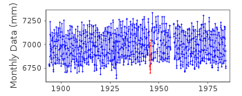
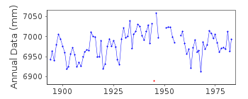
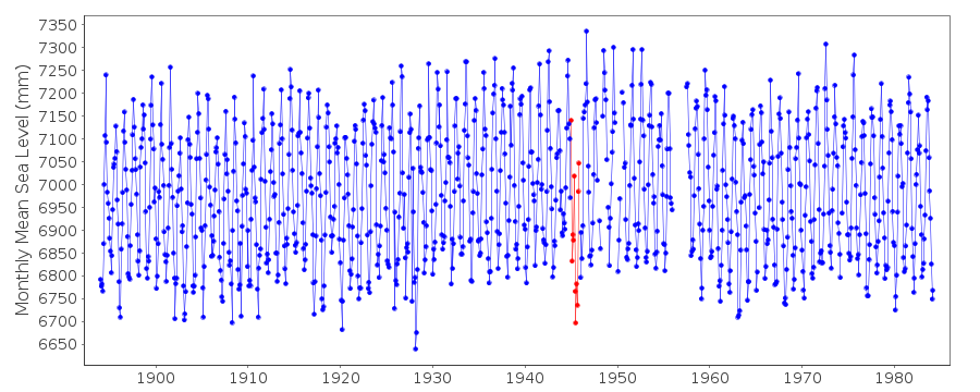
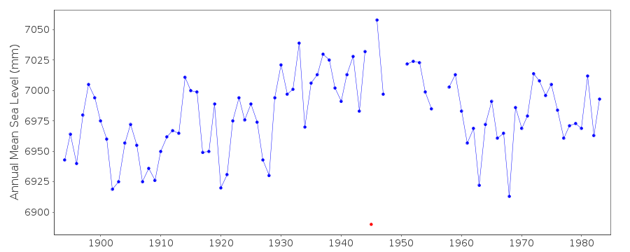
Low values compared to neighbours for June-September 1945 -correct as received from authority.
Data Authority
Japan Meteorological Agency3-6-9 Toranomon, Minato City
Tokyo

![]()
![]()
![]()
