Data
- Obtaining
- Supplying
- High-Frequency
- Bottom Pressure Records
- Other Long Records
- GLOSS/ODINAFRICA Calibration Data
Donate
Donate to PSMSL
Data Notes
- Individual Station Data and Plot Notes
- Referencing the Data Set
- PSMSL Help File
- 2010 Changes to the PSMSL Data Files
Extracted from Database
13 Jul 2026
Station Information
| Station ID: | 786 |
| Latitude: | 39.558333 |
| Longitude: | -75.573333 |
| Coastline code: | 960 |
| Station code: | 89 |
| Country: | UNITED STATES |
| Time span of RLR data: | 1985 – 2025 |
| RLR completeness (%): | 94 |
| Time span of metric data: | 1956 – 2025 |
| Metric completeness (%): | 67 |
| Date of last update: | 28 Jan 2026 |
| Green Arrow: | Current Station |
| Yellow Marker: | Neighbouring RLR Station |
| Red Marker: | Neighbouring Metric Station |
Please note: In many cases, the station position in our database is accurate to only one minute. Thus, the tide gauge may not appear to be on the coast.
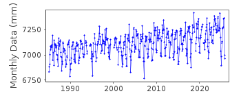
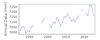
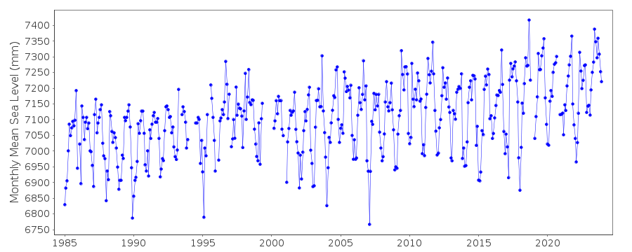
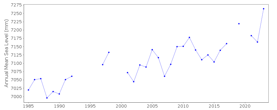
Tide Gauge Data
Station Documentation
Link to RLR information.Documentation added 1993-07-07
Reedy Point 960/089 RLR(1988) is 9.5m below BM 1 1933Documentation added 2011-11-24
Using information from the NOAA website the RLR diagram has been revised. Primary benchmark is now R 41 1979 2.031m above gauge datum. Previously used benchmark PORT PENN NO 1 1933 is referred to in the NOAA report of 1992 with a value of 3.746m. It does not appear in the 2003 report.Data Authority
N.O.A.A. / N.O.S.N/oes33, Ssmc4, Room 6531
1305 East-West Highway
Silver Spring,
MD 20910

![]()
![]()
![]()
