Data
- Obtaining
- Supplying
- High-Frequency
- Bottom Pressure Records
- Other Long Records
- GLOSS/ODINAFRICA Calibration Data
Donate
Donate to PSMSL
Data Notes
- Individual Station Data and Plot Notes
- Referencing the Data Set
- PSMSL Help File
- 2010 Changes to the PSMSL Data Files
Extracted from Database
13 Jul 2026
Station Information
| Station ID: | 742 |
| Latitude: | 51.948 |
| Longitude: | 1.292139 |
| Coastline code: | 170 |
| Station code: | 73 |
| Country: | UNITED KINGDOM |
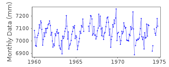
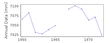
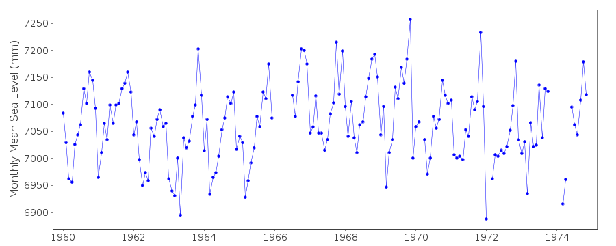
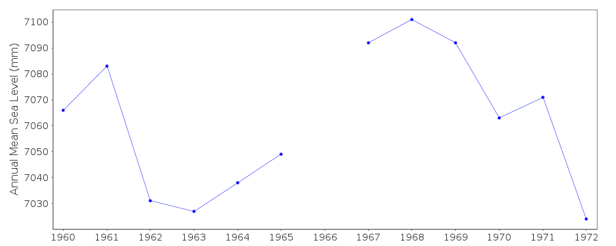
| Time span of RLR data: | 1960 – 1974 |
| RLR completeness (%): | 92 |
| Time span of metric data: | 1954 – 2025 |
| Metric completeness (%): | 52 |
| Date of last update: | 19 Feb 2026 |
| Green Arrow: | Current Station |
| Yellow Marker: | Neighbouring RLR Station |
| Red Marker: | Neighbouring Metric Station |
Please note: In many cases, the station position in our database is accurate to only one minute. Thus, the tide gauge may not appear to be on the coast.
Tide Gauge Data
Additional Data Sources (guide to additional data sources)
Nearby Real Time Stations from VLIZ: harwStation Documentation
Link to RLR information.Documentation added 1991-06-11
Harwich 170/073 RLR(1965) is 8.9m below BM TM2617 3277Documentation added 1992-04-01
Several problems with the gauge 1975-76, no RLR valuesDocumentation added 1994-09-20
A Lege stilling well gauge was installed in 1953, replaced by another Lege in June 1966, and a Lege (with a Munro transmitter) at a new site in February 1975.Documentation added 2001-01-02
Recent work on vertical land movements in the UK can be found from the University of Nottingham web site: http://ukcogr.iessg.nottingham.ac.uk/~eosi/ 1976 gauge site discountinued superceded by FelixstowePrior to 1962 values based on 8 readings per day
Documentation added 2014-07-03
04.12.2013 TGI were at site to carry out general maintenance.Documentation added 2015-05-06
There were problems with channel blocking throughout the year. There were no site visits and no levelling during 2014.Data Authority
Environment AgencyHorizon House
Deanery Road
BS1 5AH
Bristol

![]()
![]()
![]()
