Data
- Obtaining
- Supplying
- High-Frequency
- Bottom Pressure Records
- Other Long Records
- GLOSS/ODINAFRICA Calibration Data
Donate
Donate to PSMSL
Data Notes
- Individual Station Data and Plot Notes
- Referencing the Data Set
- PSMSL Help File
- 2010 Changes to the PSMSL Data Files
Extracted from Database
13 Jul 2026
WARNING: QCFLAG EXISTS. PLEASE READ THE DOCUMENTATION.
Station Information
| Station ID: | 679 |
| Latitude: | 41.25 |
| Longitude: | 141.15 |
| Coastline code: | 647 |
| Station code: | 111 |
| Country: | JAPAN |
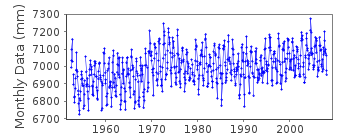
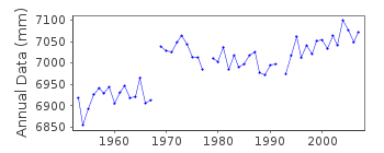
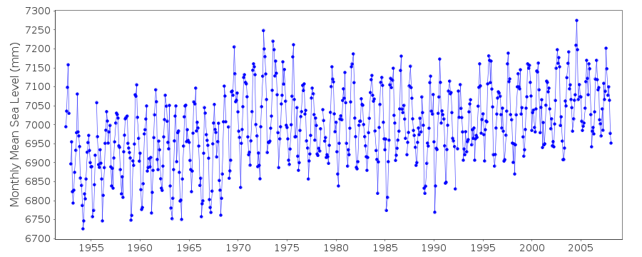
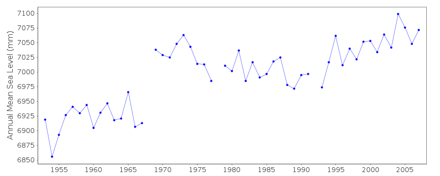
| Time span of data: | 1952 – 2008 |
| Completeness (%): | 96 |
| Date of last update: | 21 Apr 2009 |
| Green Arrow: | Current Station |
| Yellow Marker: | Neighbouring RLR Station |
| Red Marker: | Neighbouring Metric Station |
Please note: In many cases, the station position in our database is accurate to only one minute. Thus, the tide gauge may not appear to be on the coast.
Tide Gauge Data
Station Documentation
Link to RLR information.Documentation added 1991-06-11
Ominato 647/111 RLR(1974) is 8.2m below BM OminatoDocumentation added 1993-03-17
Possible datum shift in record 1969 onwards.Documentation added 2011-02-22
When Ominato is buddy checked with Asamushi profile actually fits better after the supposed datum shift.Documentation added 2013-02-21
On the original RLR diagram in the late 1980s the value for BM/TGZ varies by 2-3mm returning to 2.834m in the early 1990s. These adjustments were not incorporated and the RLRFAC remails 5.366m throughout the dataset.Data Authority
Japan Oceanographic Data CentreHydrographic Department, Maritime Safety Agency
MLIT Aomi Building
2-5-18, Aomi, Koto-ku
Tokyo 135-0064

![]()
![]()
![]()
