Data
- Obtaining
- Supplying
- High-Frequency
- Bottom Pressure Records
- Other Long Records
- GLOSS/ODINAFRICA Calibration Data
Donate
Donate to PSMSL
Data Notes
- Individual Station Data and Plot Notes
- Referencing the Data Set
- PSMSL Help File
- 2010 Changes to the PSMSL Data Files
Extracted from Database
20 Jul 2026
Station Information
| Station ID: | 638 |
| Latitude: | 64.150583 |
| Longitude: | -21.939889 |
| GLOSS ID: | 229 |
| Coastline code: | 10 |
| Station code: | 1 |
| Country: | ICELAND |
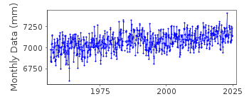
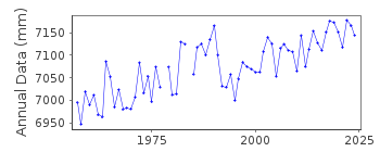
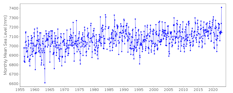
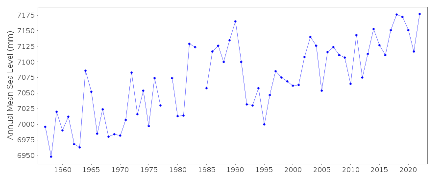
| Time span of RLR data: | 1956 – 2024 |
| RLR completeness (%): | 98 |
| Time span of metric data: | 1951 – 2024 |
| Metric completeness (%): | 92 |
| Date of last update: | 16 Sep 2025 |
| Green Arrow: | Current Station |
| Yellow Marker: | Neighbouring RLR Station |
| Red Marker: | Neighbouring Metric Station |
Please note: In many cases, the station position in our database is accurate to only one minute. Thus, the tide gauge may not appear to be on the coast.
Tide Gauge Data
Additional Data Sources (guide to additional data sources)
Nearby GNSS Stations from SONEL: REYKFast Delivery Data from UHSLC station 288: hourly and daily
Research Quality Data from UHSLC station 288: hourly and daily
Station Documentation
Link to RLR information.Documentation added 1991-06-11
Reykjavik 010/001 RLR(1973) is 17.4m below BM No.77Documentation added 1996-03-11
March 1994:new tide gauge, pressure typeDocumentation added 2010-09-23
Primary benchmark is BM 3277 12.538m above TGZ and TGZ=chart datum.Data Authority
Icelandic Coast Guard - Hydrographic DepartmentSkogarhlid 14
105 Reykjavik

![]()
![]()
![]()
