Data
- Obtaining
- Supplying
- High-Frequency
- Bottom Pressure Records
- Other Long Records
- GLOSS/ODINAFRICA Calibration Data
Donate
Donate to PSMSL
Data Notes
- Individual Station Data and Plot Notes
- Referencing the Data Set
- PSMSL Help File
- 2010 Changes to the PSMSL Data Files
Extracted from Database
13 Jul 2026
Station Information
| Station ID: | 597 |
| Latitude: | 37.246667 |
| Longitude: | -76.5 |
| Coastline code: | 960 |
| Station code: | 72 |
| Country: | UNITED STATES |
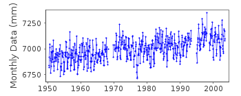
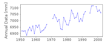
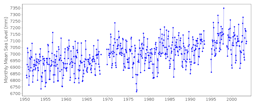
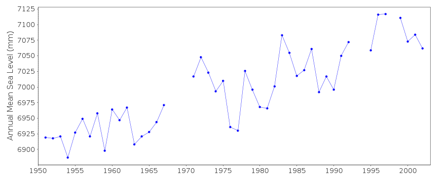
| Time span of data: | 1950 – 2003 |
| Completeness (%): | 91 |
| Date of last update: | 26 Jan 2005 |
| Green Arrow: | Current Station |
| Yellow Marker: | Neighbouring RLR Station |
| Red Marker: | Neighbouring Metric Station |
Please note: In many cases, the station position in our database is accurate to only one minute. Thus, the tide gauge may not appear to be on the coast.
Tide Gauge Data
Additional Data Sources (guide to additional data sources)
Nearby GNSS Stations from SONEL: GLPT, VAGPStation Documentation
Link to RLR information.Documentation added 1991-06-11
Gloucester Pt 960/072 RLR(1967) is 8.6m below BM7Documentation added 2011-08-11
Using data extracted from the NOAA website the RLR diagram has been re-drawn. Primary benchmark appears to be 7624 F 1979 3.917m above gauge datum. This benchmark appears in Epoch 1960-1978 and 1983-2001 with the same levelling value. The benchmark BM7 2.429m above gauge datum appears in the early Epoch as NO 7 1950 again as 2.429m relative to the datum but does not appear in the 1983-2001 Epoch.Documentation added 2015-02-23
NOAA website confirms that the station was removed in September 2003.Data Authority
N.O.A.A. / N.O.S.N/oes33, Ssmc4, Room 6531
1305 East-West Highway
Silver Spring,
MD 20910

![]()
![]()
![]()
