Data
- Obtaining
- Supplying
- High-Frequency
- Bottom Pressure Records
- Other Long Records
- GLOSS/ODINAFRICA Calibration Data
Donate
Donate to PSMSL
Data Notes
- Individual Station Data and Plot Notes
- Referencing the Data Set
- PSMSL Help File
- 2010 Changes to the PSMSL Data Files
Extracted from Database
13 Jul 2026
Station Information
| Station ID: | 548 |
| Latitude: | 16.616667 |
| Longitude: | 120.3 |
| Coastline code: | 660 |
| Station code: | 1 |
| Country: | PHILIPPINES |
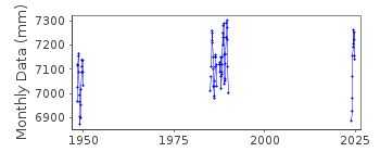
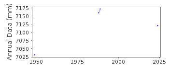
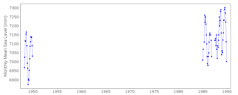
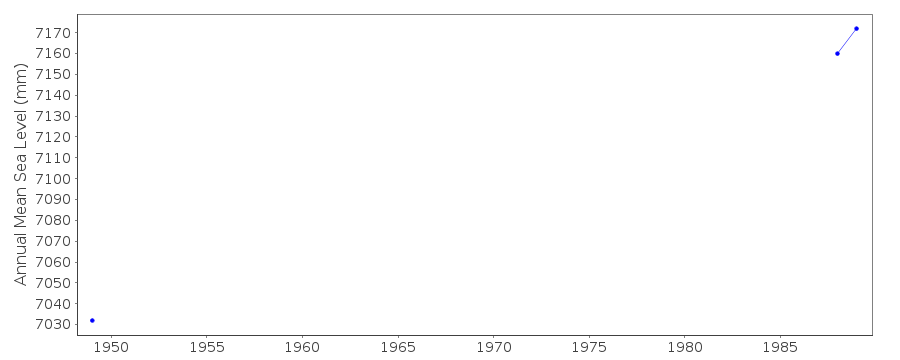
| Time span of data: | 1948 – 2024 |
| Completeness (%): | 9 |
| Date of last update: | 18 Jun 2025 |
| Green Arrow: | Current Station |
| Yellow Marker: | Neighbouring RLR Station |
| Red Marker: | Neighbouring Metric Station |
Please note: In many cases, the station position in our database is accurate to only one minute. Thus, the tide gauge may not appear to be on the coast.
Tide Gauge Data
Station Documentation
Link to RLR information.Documentation added 1991-06-11
San Fernando 660/001 RLR(1949) is 9.5m below BMNo1(1948)San Fernando is an historic station last data 1989
Data Authority
National Mapping and Resource Information AuthorityHydrography Department
421 Barraca St,
San Nicolas 1010
Manila

![]()
![]()
![]()
