Data
- Obtaining
- Supplying
- High-Frequency
- Bottom Pressure Records
- Other Long Records
- GLOSS/ODINAFRICA Calibration Data
Donate
Donate to PSMSL
Data Notes
- Individual Station Data and Plot Notes
- Referencing the Data Set
- PSMSL Help File
- 2010 Changes to the PSMSL Data Files
Extracted from Database
13 Jul 2026
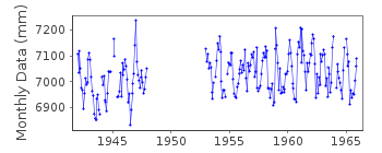
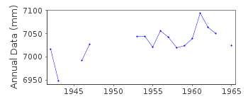
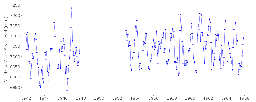
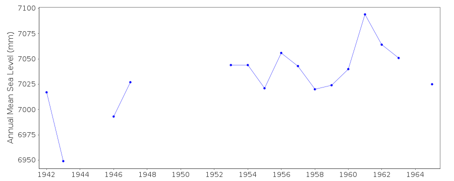
Station Information
| Station ID: | 477 |
| Latitude: | -20.15 |
| Longitude: | 57.5 |
| GLOSS ID: | 18 |
| Coastline code: | 450 |
| Station code: | 11 |
| Country: | MAURITIUS |
| Time span of data: | 1942 – 1965 |
| Completeness (%): | 76 |
| Date of last update: | 12 Jun 1991 |
| Green Arrow: | Current Station |
| Yellow Marker: | Neighbouring RLR Station |
| Red Marker: | Neighbouring Metric Station |
Please note: In many cases, the station position in our database is accurate to only one minute. Thus, the tide gauge may not appear to be on the coast.
Tide Gauge Data
Additional Data Sources (guide to additional data sources)
Nearby Real Time Stations from VLIZ: ptluFast Delivery Data from UHSLC station 103: hourly and daily
Research Quality Data from UHSLC station 103: hourly and daily
Station Documentation
Link to RLR information.Documentation added 1991-06-13
PORT LOUIS 450/011 RLR(1963) IS 8.8M BELOW BM NO1 MUNRO GAUGEDocumentation added 2012-08-08
This is now an historic station. Last data December 1965.Data Authority
Meteorological ServicesMeteorological Services Headquarters
St. Paul Road
Vacoas

![]()
![]()
![]()
