Data
- Obtaining
- Supplying
- High-Frequency
- Bottom Pressure Records
- Other Long Records
- GLOSS/ODINAFRICA Calibration Data
Donate
Donate to PSMSL
Data Notes
- Individual Station Data and Plot Notes
- Referencing the Data Set
- PSMSL Help File
- 2010 Changes to the PSMSL Data Files
Extracted from Database
13 Jul 2026
Station Information
| Station ID: | 415 |
| Latitude: | 10.65 |
| Longitude: | -61.516667 |
| GLOSS ID: | 203 |
| Coastline code: | 890 |
| Station code: | 1 |
| Country: | TRINIDAD AND TOBAGO |
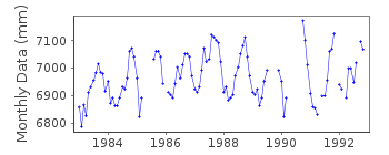
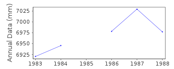
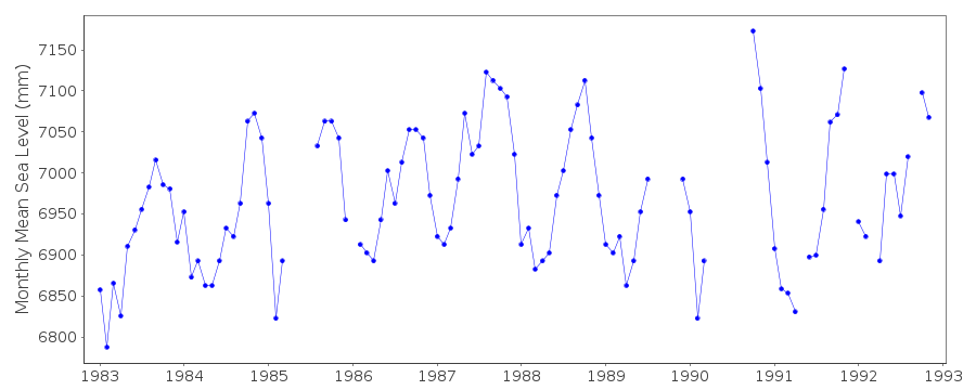
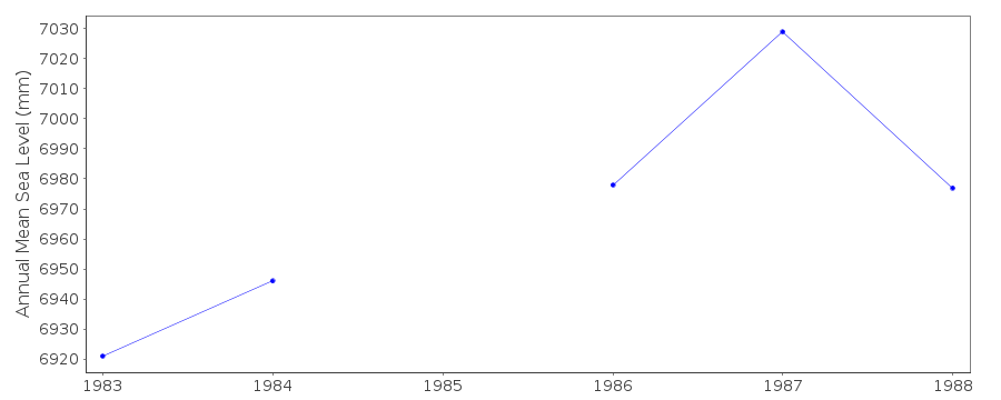
| Time span of RLR data: | 1983 – 1992 |
| RLR completeness (%): | 83 |
| Time span of metric data: | 1937 – 1992 |
| Metric completeness (%): | 22 |
| Date of last update: | 15 Nov 1999 |
| Green Arrow: | Current Station |
| Yellow Marker: | Neighbouring RLR Station |
| Red Marker: | Neighbouring Metric Station |
Please note: In many cases, the station position in our database is accurate to only one minute. Thus, the tide gauge may not appear to be on the coast.
Tide Gauge Data
Additional Data Sources (guide to additional data sources)
Nearby GNSS Stations from SONEL: TTUWNearby Real Time Stations from VLIZ: ptsp
Research Quality Data from UHSLC station 248: hourly and daily
Station Documentation
Link to RLR information.Documentation - date unknown
PRIOR TO 1983 DATA WAS SUPPLIED BY THE HARBOUR AUTHORITYDocumentation added 1991-06-11
Port of Spain 890/001 RLR(1987) is 8.6m below HUBM001Documentation added 1992-10-21
1983-85 NEYRTEC GAUGE, MUNRO GAUGE INSTALLED IN 19851989 MUNRO GAUGE DESTROYED BY HEAVY SWELL IN JULY,
NEYRTEC GAUGE INSTALLED IN NOVEMBER
Documentation added 1993-07-12
Port of Spain 890/001 RLR(1987) is 8.6m below HUBM001Documentation added 1999-11-15
Data for 1991-92 were obtained from University of Hawaii digitisationof charts from Port of Spain.
Port of Spain is an historic station last data 1992
Data Authority
Hydrographic UnitP.O. Box 1104
Port of Spain

![]()
![]()
![]()
