Data
- Obtaining
- Supplying
- High-Frequency
- Bottom Pressure Records
- Other Long Records
- GLOSS/ODINAFRICA Calibration Data
Donate
Donate to PSMSL
Data Notes
- Individual Station Data and Plot Notes
- Referencing the Data Set
- PSMSL Help File
- 2010 Changes to the PSMSL Data Files
Extracted from Database
13 Jul 2026
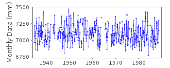
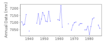
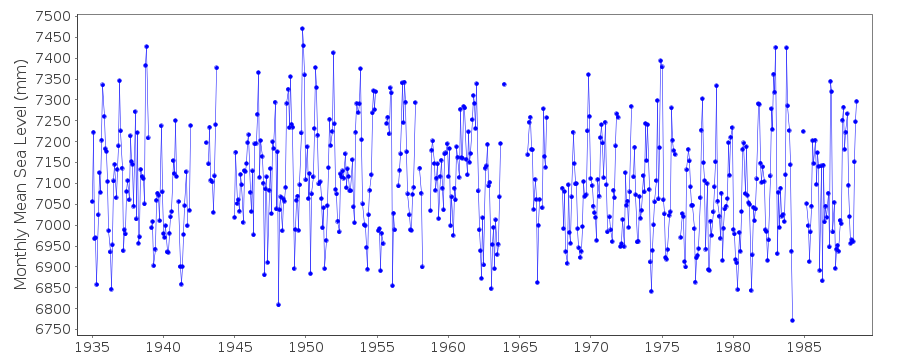
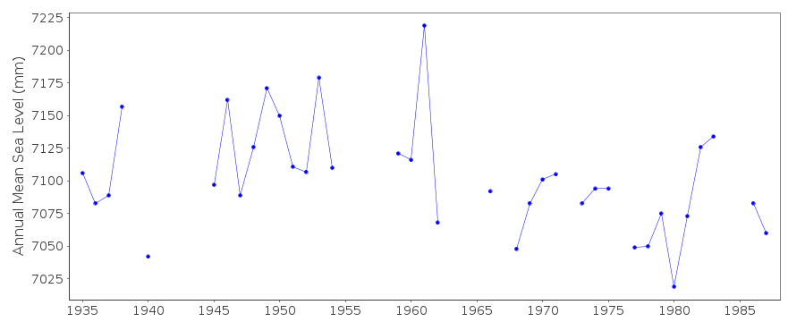
Station Information
| Station ID: | 398 |
| Latitude: | 61.916667 |
| Longitude: | 5.633333 |
| Coastline code: | 40 |
| Station code: | 201 |
| Country: | NORWAY |
| Time span of data: | 1935 – 1988 |
| Completeness (%): | 85 |
| Date of last update: | 10 Oct 1994 |
| Green Arrow: | Current Station |
| Yellow Marker: | Neighbouring RLR Station |
| Red Marker: | Neighbouring Metric Station |
Please note: In many cases, the station position in our database is accurate to only one minute. Thus, the tide gauge may not appear to be on the coast.
Tide Gauge Data
Station Documentation
Link to RLR information.Documentation added 1991-06-11
Kjolsdal 040/201 RLR(1964) is 8.7m below BM B29N16Documentation added 1993-07-12
Kjolsdal 040/201 RLR(1964) is 8.7m below BM B29N16Documentation added 1993-10-06
DATA UP TO 1986 FROM AUTHORITY CODE 03Documentation added 1994-10-10
1988 gauge taken out of serviceData Authority
Norwegian Mapping AuthorityHydrographic Service
Po. Box 60
4001 Stavanger

![]()
![]()
![]()
