Data
- Obtaining
- Supplying
- High-Frequency
- Bottom Pressure Records
- Other Long Records
- GLOSS/ODINAFRICA Calibration Data
Donate
Donate to PSMSL
Data Notes
- Individual Station Data and Plot Notes
- Referencing the Data Set
- PSMSL Help File
- 2010 Changes to the PSMSL Data Files
Extracted from Database
13 Jul 2026
Station Information
| Station ID: | 236 |
| Latitude: | 53.363056 |
| Longitude: | 5.22 |
| Coastline code: | 150 |
| Station code: | 11 |
| Country: | NETHERLANDS, KINGDOM OF THE |
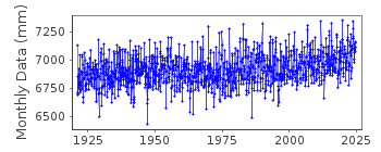
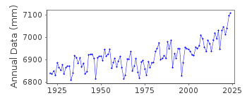
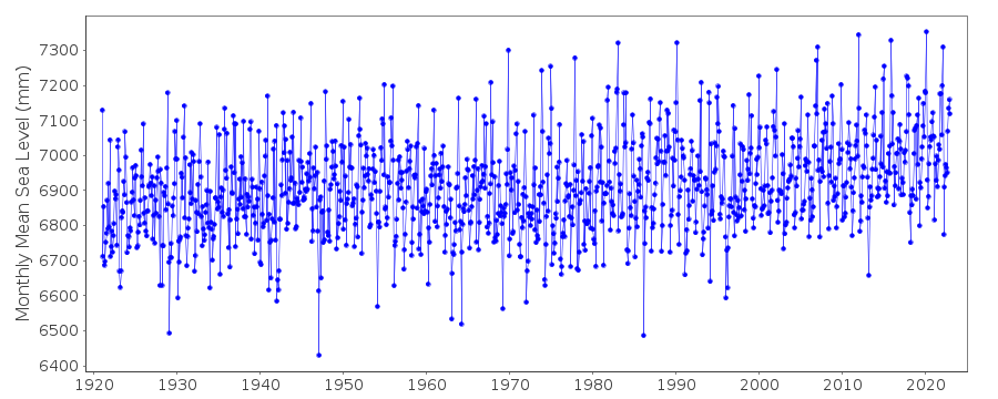
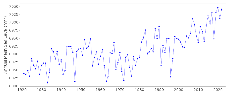
| Time span of data: | 1921 – 2024 |
| Completeness (%): | 100 |
| Date of last update: | 14 Nov 2025 |
| Green Arrow: | Current Station |
| Yellow Marker: | Neighbouring RLR Station |
| Red Marker: | Neighbouring Metric Station |
Please note: In many cases, the station position in our database is accurate to only one minute. Thus, the tide gauge may not appear to be on the coast.
Tide Gauge Data
Station Documentation
Link to RLR information.Documentation - date unknown
ALL DUTCH METRIC DATA ARE MEASURED TO NAP (NORMAAL AMSTERDAMSCH PEIL) 1921 -1922 VALUES BASED ON 4 READINGS/DAYDocumentation added 2011-02-08
From levelling data received from Douwe Dillingh it was possible to calculate RLR using values before NAP was re-levelled in 2005. RLR factors up to 2005 6.936m 2005 onwards 6.957m.Data Authority
Servicedesk DataRijkswaterstaat
Postbus 556
3000 AN Rotterdam

![]()
![]()
![]()
