Data
- Obtaining
- Supplying
- High-Frequency
- Bottom Pressure Records
- Other Long Records
- GLOSS/ODINAFRICA Calibration Data
Donate
Donate to PSMSL
Data Notes
- Individual Station Data and Plot Notes
- Referencing the Data Set
- PSMSL Help File
- 2010 Changes to the PSMSL Data Files
Extracted from Database
20 Jul 2026
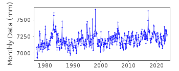
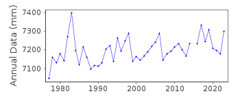
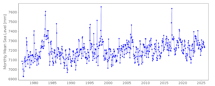
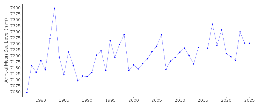
Station Information
| Station ID: | 2330 |
| Latitude: | 38.055 |
| Longitude: | -122.04 |
| Coastline code: | 823 |
| Station code: | 33 |
| Country: | UNITED STATES |
| Time span of data: | 1976 – 2025 |
| Completeness (%): | 98 |
| Date of last update: | 28 Jan 2026 |
| Green Arrow: | Current Station |
| Yellow Marker: | Neighbouring RLR Station |
| Red Marker: | Neighbouring Metric Station |
Please note: In many cases, the station position in our database is accurate to only one minute. Thus, the tide gauge may not appear to be on the coast.
Tide Gauge Data
Station Documentation
Link to RLR information.Documentation added 2017-02-15
Port Chicago California is a new NOAA station. This has been added to the database to give additional comparison stations.Using metadata from the NOAA website Port Chicago, California has been made RLR. Primary benchmark is 5144 H 1976 4.209m above Station Datum.Data Authority
N.O.A.A. / N.O.S.N/oes33, Ssmc4, Room 6531
1305 East-West Highway
Silver Spring,
MD 20910

![]()
![]()
![]()
