Data
- Obtaining
- Supplying
- High-Frequency
- Bottom Pressure Records
- Other Long Records
- GLOSS/ODINAFRICA Calibration Data
Donate
Donate to PSMSL
Data Notes
- Individual Station Data and Plot Notes
- Referencing the Data Set
- PSMSL Help File
- 2010 Changes to the PSMSL Data Files
Extracted from Database
20 Jul 2026
Station Information
| Station ID: | 2294 |
| Latitude: | 35.223333 |
| Longitude: | -75.635 |
| Coastline code: | 960 |
| Station code: | 59 |
| Country: | UNITED STATES |
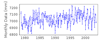
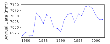
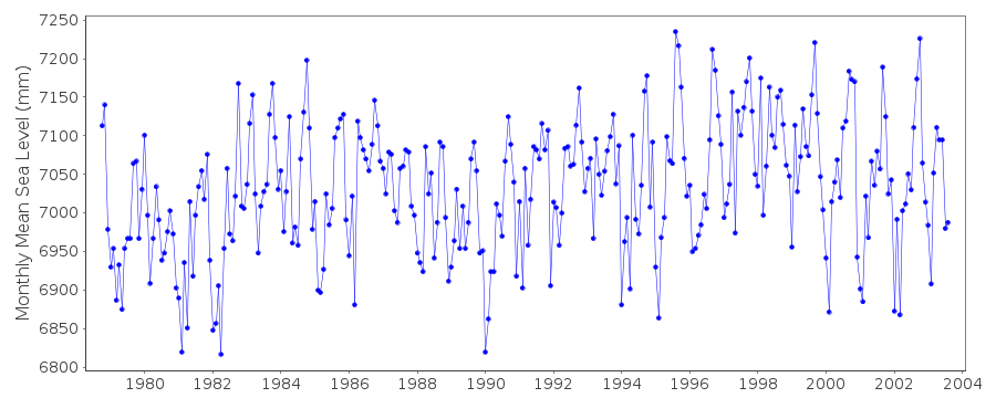
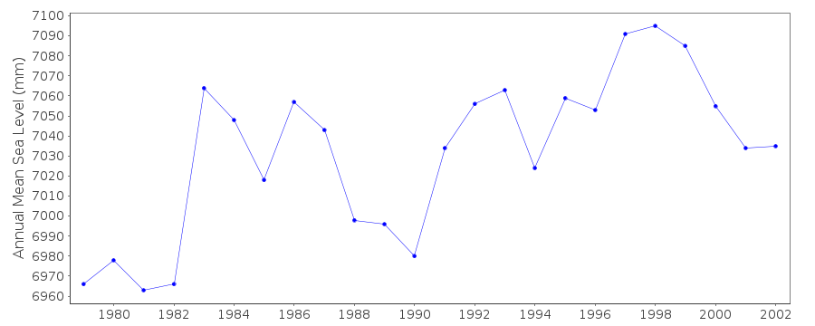
| Time span of data: | 1978 – 2003 |
| Completeness (%): | 96 |
| Date of last update: | 26 Apr 2016 |
| Green Arrow: | Current Station |
| Yellow Marker: | Neighbouring RLR Station |
| Red Marker: | Neighbouring Metric Station |
Please note: In many cases, the station position in our database is accurate to only one minute. Thus, the tide gauge may not appear to be on the coast.
Tide Gauge Data
Station Documentation
Link to RLR information.Documentation added 2016-04-26
Cape Hatteras, North Carolina is a newly downloaded NOAA station. Primary benchmark is NO 1 1973.Data Authority
N.O.A.A. / N.O.S.N/oes33, Ssmc4, Room 6531
1305 East-West Highway
Silver Spring,
MD 20910

![]()
![]()
![]()
