Data
- Obtaining
- Supplying
- High-Frequency
- Bottom Pressure Records
- Other Long Records
- GLOSS/ODINAFRICA Calibration Data
Donate
Donate to PSMSL
Data Notes
- Individual Station Data and Plot Notes
- Referencing the Data Set
- PSMSL Help File
- 2010 Changes to the PSMSL Data Files
Extracted from Database
20 Jul 2026
Station Information
| Station ID: | 2128 |
| Latitude: | 20.036667 |
| Longitude: | -155.83 |
| Coastline code: | 760 |
| Station code: | 56 |
| Country: | UNITED STATES |
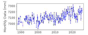
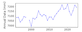
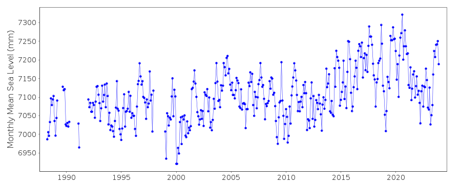
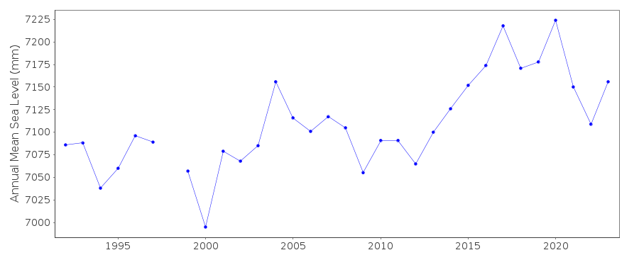
| Time span of data: | 1988 – 2025 |
| Completeness (%): | 92 |
| Date of last update: | 28 Jan 2026 |
| Green Arrow: | Current Station |
| Yellow Marker: | Neighbouring RLR Station |
| Red Marker: | Neighbouring Metric Station |
Please note: In many cases, the station position in our database is accurate to only one minute. Thus, the tide gauge may not appear to be on the coast.
Tide Gauge Data
Additional Data Sources (guide to additional data sources)
Nearby Real Time Stations from VLIZ: kawaFast Delivery Data from UHSLC station 552: hourly and daily
Research Quality Data from UHSLC station 552: hourly and daily
Station Documentation
Link to RLR information.Documentation added 2012-01-24
Kawaihae, Hawaii Island has been downloaded from NOAA as a new station. Station is RLR, Primary benchmark is 7433 B 1989 3.094m above TGZ. RLR factor is 6.006m.Documentation added 2018-03-13
Hawaii Island is a volcanic island and so there could be consequently related datum shifts within the records from the tide gauge at Kawaihae. Visible 'shifts' in the data in both 1999 and 2006 seem to be as a result of 'real' events. That in 2006 appears to be an earthquake or other eruption.Data Authority
N.O.A.A. / N.O.S.N/oes33, Ssmc4, Room 6531
1305 East-West Highway
Silver Spring,
MD 20910

![]()
![]()
![]()
