Data
- Obtaining
- Supplying
- High-Frequency
- Bottom Pressure Records
- Other Long Records
- GLOSS/ODINAFRICA Calibration Data
Donate
Donate to PSMSL
Data Notes
- Individual Station Data and Plot Notes
- Referencing the Data Set
- PSMSL Help File
- 2010 Changes to the PSMSL Data Files
Extracted from Database
13 Jul 2026
Station Information
| Station ID: | 2119 |
| Latitude: | 18.316667 |
| Longitude: | -64.723333 |
| Coastline code: | 939 |
| Station code: | 21 |
| Country: | VIRGIN ISLANDS, U.S. |
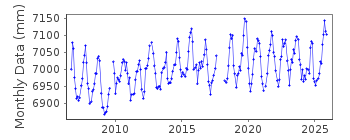
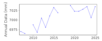
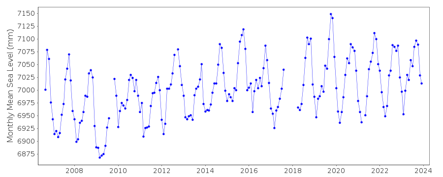
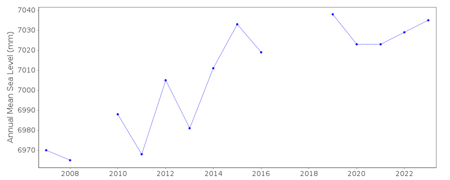
| Time span of data: | 2006 – 2025 |
| Completeness (%): | 92 |
| Date of last update: | 28 Jan 2026 |
| Green Arrow: | Current Station |
| Yellow Marker: | Neighbouring RLR Station |
| Red Marker: | Neighbouring Metric Station |
Please note: In many cases, the station position in our database is accurate to only one minute. Thus, the tide gauge may not appear to be on the coast.
Tide Gauge Data
Additional Data Sources (guide to additional data sources)
Nearby Real Time Stations from VLIZ: lame, lame2Research Quality Data from UHSLC station 214: hourly and daily
Station Documentation
Link to RLR information.Documentation added 2012-01-23
Lameshur Bay St. John Virgin Islands is a new station downloaded from NOAA. The metadata were also downloaded enabling the station to be made RLR. Primary benchmark is 1381 A 2006 10.000m above TGZ.Documentation added 2015-02-04
The original RLR diagram contained an error and was redrawn. However, the RLR factor applied to the data was correct, thus none of the RLR values have changed.Data Authority
N.O.A.A. / N.O.S.N/oes33, Ssmc4, Room 6531
1305 East-West Highway
Silver Spring,
MD 20910

![]()
![]()
![]()
