Data
- Obtaining
- Supplying
- High-Frequency
- Bottom Pressure Records
- Other Long Records
- GLOSS/ODINAFRICA Calibration Data
Donate
Donate to PSMSL
Data Notes
- Individual Station Data and Plot Notes
- Referencing the Data Set
- PSMSL Help File
- 2010 Changes to the PSMSL Data Files
Extracted from Database
13 Jul 2026
Station Information
| Station ID: | 2108 |
| Latitude: | 55.416667 |
| Longitude: | 12.829444 |
| Coastline code: | 50 |
| Station code: | 56 |
| Country: | SWEDEN |
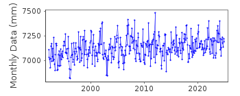
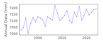
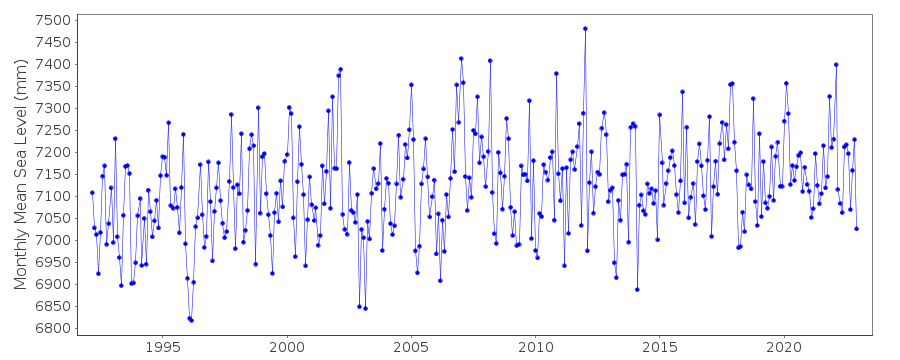
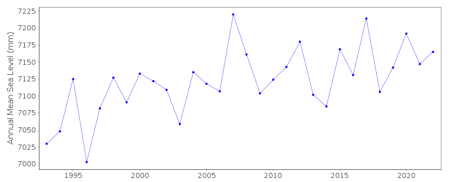
| Time span of data: | 1992 – 2024 |
| Completeness (%): | 99 |
| Date of last update: | 27 May 2025 |
| Green Arrow: | Current Station |
| Yellow Marker: | Neighbouring RLR Station |
| Red Marker: | Neighbouring Metric Station |
Please note: In many cases, the station position in our database is accurate to only one minute. Thus, the tide gauge may not appear to be on the coast.
Tide Gauge Data
Additional Data Sources (guide to additional data sources)
Nearby GNSS Stations from SONEL: 0SKNNearby Real Time Stations from VLIZ: skan
Station Documentation
Link to RLR information.Documentation added 2011-12-07
Although the tide gauge at Skanor has been operational since 1992 it has just been included into the database. There are now 23 Swedish stations on the database.Documentation added 2015-04-07
The RLR diagram incorrectly referenced the data to the tide gauge zero value rather than to the local height system. We have redrawn the RLR diagram and removed the reference to tide gauge zero. The RLR height did change, but the RLR factor applied to the metric data did not change.Data Authority
Swedish Met. and Hyd. InstituteBox 923
S601 76 Norrkoping

![]()
![]()
![]()
