Data
- Obtaining
- Supplying
- High-Frequency
- Bottom Pressure Records
- Other Long Records
- GLOSS/ODINAFRICA Calibration Data
Donate
Donate to PSMSL
Data Notes
- Individual Station Data and Plot Notes
- Referencing the Data Set
- PSMSL Help File
- 2010 Changes to the PSMSL Data Files
Extracted from Database
13 Jul 2026
Station Information
| Station ID: | 2092 |
| Latitude: | 40.841406 |
| Longitude: | 14.269194 |
| Coastline code: | 250 |
| Station code: | 46 |
| Country: | ITALY |
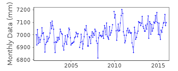
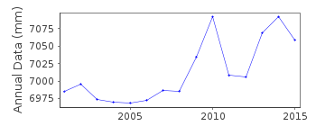
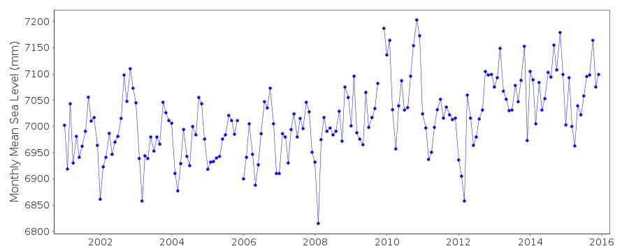
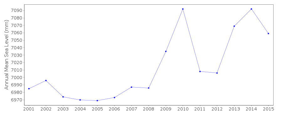
| Time span of data: | 2001 – 2015 |
| Completeness (%): | 99 |
| Date of last update: | 18 Oct 2016 |
| Green Arrow: | Current Station |
| Yellow Marker: | Neighbouring RLR Station |
| Red Marker: | Neighbouring Metric Station |
Please note: In many cases, the station position in our database is accurate to only one minute. Thus, the tide gauge may not appear to be on the coast.
Tide Gauge Data
Additional Data Sources (guide to additional data sources)
Nearby GNSS Stations from SONEL: NAPONearby Real Time Stations from VLIZ: NA23
Station Documentation
Link to RLR information.Documentation added 2011-11-21
Napoli II is a new station, data and metadata downloaded from the IstitutoSuperiore per la Protezione e la Ricerca Ambientale (ISPRA) website. Data
January 2001 onwards. Database id. 2092.
Documentation added 2012-08-02
Napoli II has been made RLR. Primary bencmark 0120_004P is 3.786m abovenational Italian Military Geographic Institute (IGM) altimetric datum.
Data Authority
Institute for Environmental Protection and ResearchVia Vitaliano
Brancati 48
00144 Roma

![]()
![]()
![]()
