Data
- Obtaining
- Supplying
- High-Frequency
- Bottom Pressure Records
- Other Long Records
- GLOSS/ODINAFRICA Calibration Data
Donate
Donate to PSMSL
Data Notes
- Individual Station Data and Plot Notes
- Referencing the Data Set
- PSMSL Help File
- 2010 Changes to the PSMSL Data Files
Extracted from Database
13 Jul 2026
Station Information
| Station ID: | 2067 |
| Latitude: | 35.487453 |
| Longitude: | 24.082481 |
| Coastline code: | 290 |
| Station code: | 99 |
| Country: | GREECE |
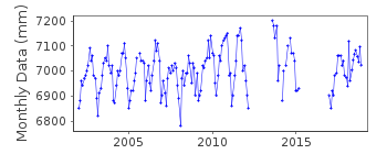
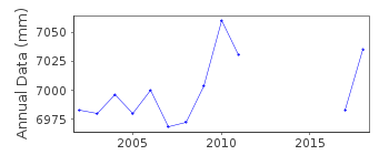
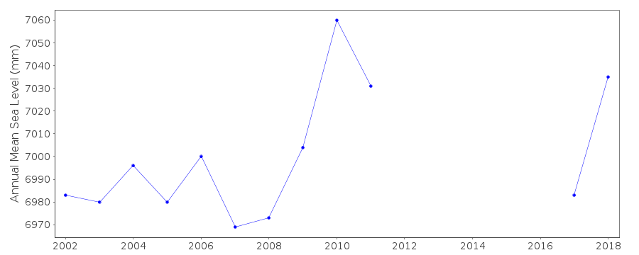
| Time span of data: | 2002 – 2018 |
| Completeness (%): | 80 |
| Date of last update: | 28 Nov 2019 |
| Green Arrow: | Current Station |
| Yellow Marker: | Neighbouring RLR Station |
| Red Marker: | Neighbouring Metric Station |
Please note: In many cases, the station position in our database is accurate to only one minute. Thus, the tide gauge may not appear to be on the coast.
Tide Gauge Data
Station Documentation
Link to RLR information.Documentation added 2011-03-10
Station Soudhas 2002 onwards was split off to create Soudhas II. The Originalbenchmark for Soudhas was BMR145 which was destroyed. The Hellenic Navy have no
information on how this benchmark relates to the currently used R12 2.618m
above TGZ.
Documentation added 2013-08-12
Using new information from the Hellenic Navy the dataset for Soudhas can now be rejoined.See id.1232 for full dataset. No further data will be added to this id.Documentation added 2018-09-19
There is a gap in the data for Soudhas II from March 2015 - January 2017.Data Authority
Hellenic Navy Hydrographic ServiceGeographic Policy and International Relations Office
TGN 1040
Athens

![]()
![]()
![]()
