
Data
- Obtaining
- Supplying
- High-Frequency
- Bottom Pressure Records
- Other Long Records
- GLOSS/ODINAFRICA Calibration Data
Donate
Donate to PSMSL
Data Notes
- Individual Station Data and Plot Notes
- Referencing the Data Set
- PSMSL Help File
- 2010 Changes to the PSMSL Data Files
Extracted from Database
12 Oct 2026
Station Information
| Station ID: | 2057 |
| Latitude: | 35.29061 |
| Longitude: | -2.92853 |
| Coastline code: | 340 |
| Station code: | 3 |
| Country: | SPAIN |
| Time span of data: | 2008 – 2025 |
| Completeness (%): | 94 |
| Link to ellipsoid: | Available |
| Date of last update: | 17 Jul 2026 |
| Green Arrow: | Current Station |
| Yellow Marker: | Neighbouring RLR Station |
| Red Marker: | Neighbouring Metric Station |
Please note: In many cases, the station position in our database is accurate to only one minute. Thus, the tide gauge may not appear to be on the coast.
Tide Gauge Data
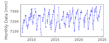
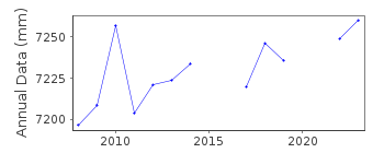

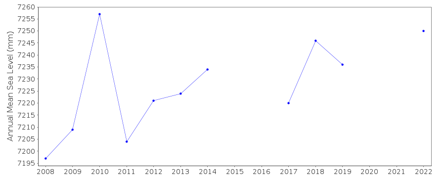
Additional Data Sources (guide to additional data sources)
Nearby GNSS Stations from SONEL: MLLL00ESP, MELI00ESPNearby Real Time Stations from VLIZ: meli
Station Documentation
Link to RLR information.Documentation added 2011-01-24
Mellila is a new station and is part of the newly established REDMAR network. BenchmarkC.N. 2.0m relative to REDMAR network. The datum was changed by 15.5cm in July 2011 the supplied data had been adjusted accordingly so complete dataset was re-loaded.
See paper B. Perez et al 'Overlapping sea level time series measured using different technologies: an example from the REDMAR Spanish network'.
Documentation added 2014-04-29
At the request of Puertos del Estado the latitude and longitude have been revised from 35.291667 -2.928333 derived from the previously supplied degrees and minute value to 35.29061 -2.92853 the site of the new MIROS gauge in decimal degrees.Documentation added 2026-07-23
Melilla data are affected by an incident which was caused by the impact of a vessel which tilted the station, occurred on 25 November 2024 (between 13:07 and 13:19 UTC) and lasted until 26 February 2025. The station was repaired and normal operation was restored on 26 February 2025.Data Authority
Puertos del EstadoÁrea de Conocimiento y Análisis del Medio Físico
Avda. Del Partenón, 10
28042, Madrid
Documentation added 2001-03-06
The Area de Conocimiento y Analisis del Medio Fisico wasformerly known as the Departamento de Clima Maritimo.