Data
- Obtaining
- Supplying
- High-Frequency
- Bottom Pressure Records
- Other Long Records
- GLOSS/ODINAFRICA Calibration Data
Donate
Donate to PSMSL
Data Notes
- Individual Station Data and Plot Notes
- Referencing the Data Set
- PSMSL Help File
- 2010 Changes to the PSMSL Data Files
Extracted from Database
20 Jul 2026
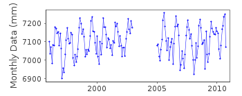
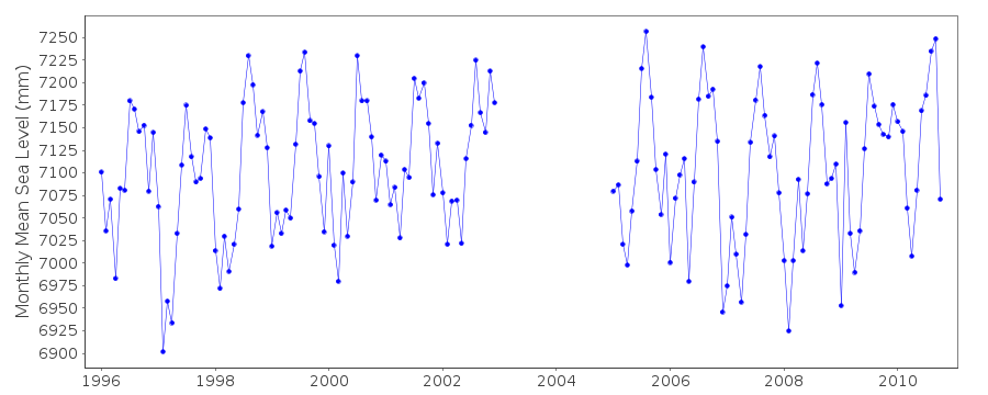
Station Information
| Station ID: | 1880 |
| Latitude: | 32.083333 |
| Longitude: | 34.766667 |
| Coastline code: | 320 |
| Station code: | 19 |
| Country: | ISRAEL |
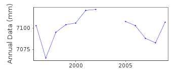
| Time span of data: | 1996 – 2010 |
| Completeness (%): | 86 |
| Date of last update: | 03 Jul 2012 |
| Green Arrow: | Current Station |
| Yellow Marker: | Neighbouring RLR Station |
| Red Marker: | Neighbouring Metric Station |
Please note: In many cases, the station position in our database is accurate to only one minute. Thus, the tide gauge may not appear to be on the coast.
Tide Gauge Data
Station Documentation
Link to RLR information.Documentation added 2000-06-26
Tel Aviv 320/019 RLR(1998) is 9.972m below BM55FDocumentation added 2009-03-02
Data for 2008 loaded onto the database. Awaiting further data 2001-2007 from Survey of Israel. Because of this 2008 data entered as Metric. All data now RLR again.Documentation added 2013-01-10
As from Oct. 2010 this station has now been replaced by Tel Aviv-Yasso id. 2147Data Authority
Research DepartmentSurvey of Israel
1 Lincoln Street
Tel Aviv 65200

![]()
![]()
![]()
