Data
- Obtaining
- Supplying
- High-Frequency
- Bottom Pressure Records
- Other Long Records
- GLOSS/ODINAFRICA Calibration Data
Donate
Donate to PSMSL
Data Notes
- Individual Station Data and Plot Notes
- Referencing the Data Set
- PSMSL Help File
- 2010 Changes to the PSMSL Data Files
Extracted from Database
20 Jul 2026
Station Information
| Station ID: | 1867 |
| Latitude: | 55.206778 |
| Longitude: | -6.656833 |
| Coastline code: | 170 |
| Station code: | 261 |
| Country: | UNITED KINGDOM |
| Time span of data: | 1995 – 2025 |
| Completeness (%): | 79 |
| Date of last update: | 19 Feb 2026 |
| Green Arrow: | Current Station |
| Yellow Marker: | Neighbouring RLR Station |
| Red Marker: | Neighbouring Metric Station |
Please note: In many cases, the station position in our database is accurate to only one minute. Thus, the tide gauge may not appear to be on the coast.
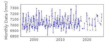
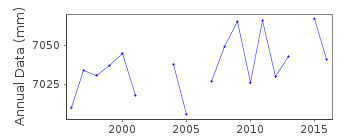
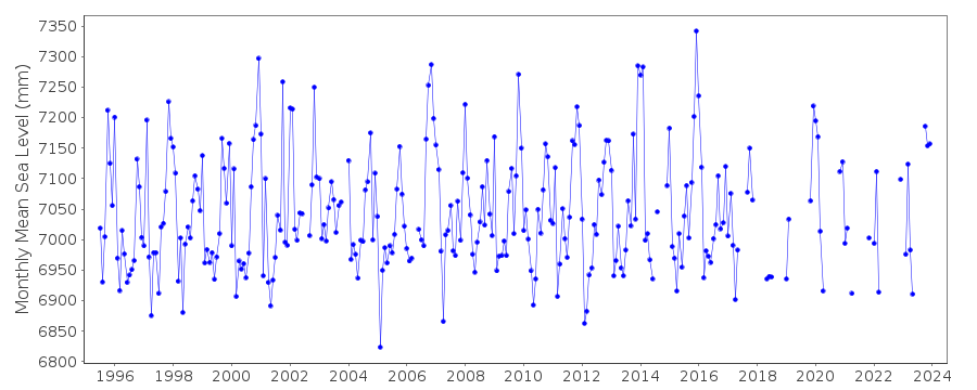
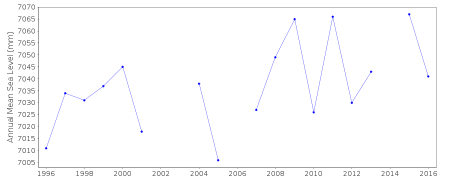
Tide Gauge Data
Additional Data Sources (guide to additional data sources)
Nearby Real Time Stations from VLIZ: prusStation Documentation
Link to RLR information.Documentation added 2001-01-02
Recent work on vertical land movements in the UK can be found fromthe University of Nottingham web site:
http://ukcogr.iessg.nottingham.ac.uk/~eosi/
Documentation added 2014-07-04
There were two visits by TGI to Portrush during 2013. 14.01.2013 when a new GSM antenna to improve data retrieval was fitted together with new DQ cards and again on 12.09.2013 when general and diving maintenance was carried out.Documentation added 2015-06-02
From June-Sept data values were ~25mm high then from Oct-Dec there were problems with blocking. TGI were at site 13.05.14 for general maintenance and change the compressor and 13.08.14 again for general maintenance and an inspection dive.Data Authority
Environment AgencyHorizon House
Deanery Road
BS1 5AH
Bristol

![]()
![]()
![]()
