Data
- Obtaining
- Supplying
- High-Frequency
- Bottom Pressure Records
- Other Long Records
- GLOSS/ODINAFRICA Calibration Data
Donate
Donate to PSMSL
Data Notes
- Individual Station Data and Plot Notes
- Referencing the Data Set
- PSMSL Help File
- 2010 Changes to the PSMSL Data Files
Extracted from Database
13 Jul 2026
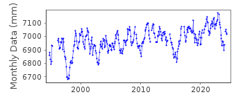
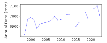
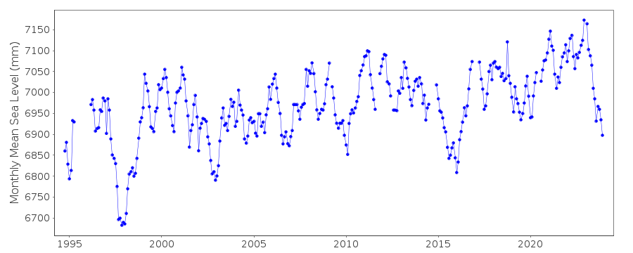
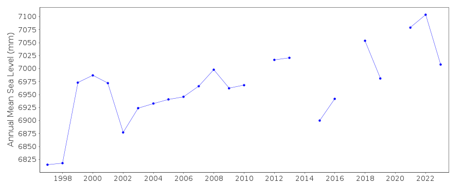
Station Information
| Station ID: | 1860 |
| Latitude: | -2.042083 |
| Longitude: | 147.373778 |
| GLOSS ID: | 331 |
| Coastline code: | 670 |
| Station code: | 43 |
| Country: | PAPUA NEW GUINEA |
| Time span of data: | 1994 – 2026 |
| Completeness (%): | 86 |
| Link to ellipsoid: | Available |
| Date of last update: | 01 Jun 2026 |
| Green Arrow: | Current Station |
| Yellow Marker: | Neighbouring RLR Station |
| Red Marker: | Neighbouring Metric Station |
Please note: In many cases, the station position in our database is accurate to only one minute. Thus, the tide gauge may not appear to be on the coast.
Tide Gauge Data
Additional Data Sources (guide to additional data sources)
Nearby GNSS Stations from SONEL: PNGMNearby Real Time Stations from VLIZ: lomb
Fast Delivery Data from UHSLC station 400: hourly and daily
Research Quality Data from UHSLC station 400: hourly and daily
Station Documentation
Link to RLR information.Documentation added 1998-01-06
Lombrum is an NTF SEAFRAME stationDocumentation added 1998-01-21
1995 (April-Dec): gauge was decommissioned while the jetty was repairedDocumentation added 2010-08-25
Supplying authority has confirmed that benchmark PNG 1 is 2.2988 m above tide gauge zero.RLR (2008) is defined as as 8.5 m below benchmark PNG 1Data Authority
National Tidal CentreBureau of Meteorology
PO Box 421
Kent Town 5071
South Australia
Documentation added 2010-08-12
Formerly known as the National Tidal Facility

![]()
![]()
![]()
