Data
- Obtaining
- Supplying
- High-Frequency
- Bottom Pressure Records
- Other Long Records
- GLOSS/ODINAFRICA Calibration Data
Donate
Donate to PSMSL
Data Notes
- Individual Station Data and Plot Notes
- Referencing the Data Set
- PSMSL Help File
- 2010 Changes to the PSMSL Data Files
Extracted from Database
13 Jul 2026
Station Information
| Station ID: | 1859 |
| Latitude: | 44.1233 |
| Longitude: | 15.235 |
| Coastline code: | 280 |
| Station code: | 13 |
| Country: | CROATIA |
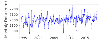
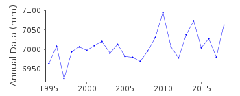
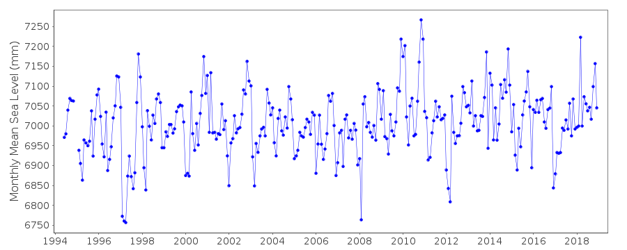
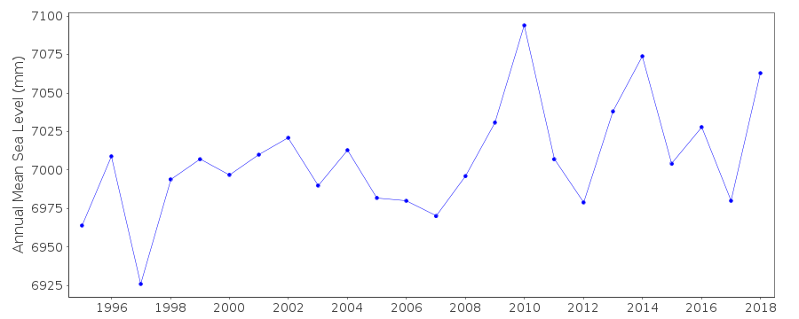
| Time span of data: | 1994 – 2018 |
| Completeness (%): | 98 |
| Date of last update: | 11 Jul 2019 |
| Green Arrow: | Current Station |
| Yellow Marker: | Neighbouring RLR Station |
| Red Marker: | Neighbouring Metric Station |
Please note: In many cases, the station position in our database is accurate to only one minute. Thus, the tide gauge may not appear to be on the coast.
Tide Gauge Data
Station Documentation
Link to RLR information.Documentation added 1996-01-12
Tide gauge of the State Hydrographic Institute at SplitDocumentation added 1996-01-12
Gauge=A. Ott, KemptenDocumentation added 2010-11-04
After entering the data for 2008 Zadar was buddy checked with Bakar. The profiles agree.Data Authority
Hidrografski Institut of Rep. of CroatiaZrinsko-Frankopanska 161
21000 Split

![]()
![]()
![]()
