Data
- Obtaining
- Supplying
- High-Frequency
- Bottom Pressure Records
- Other Long Records
- GLOSS/ODINAFRICA Calibration Data
Donate
Donate to PSMSL
Data Notes
- Individual Station Data and Plot Notes
- Referencing the Data Set
- PSMSL Help File
- 2010 Changes to the PSMSL Data Files
Extracted from Database
13 Jul 2026
Station Information
| Station ID: | 1745 |
| Latitude: | 16.833333 |
| Longitude: | 112.333333 |
| Coastline code: | 610 |
| Station code: | 4 |
| Country: | CHINA |
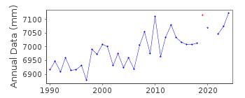
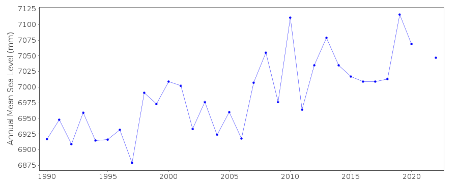
| Time span of RLR data: | 1990 – 2024 |
| RLR completeness (%): | 98 |
| Time span of metric data: | 1989 – 2024 |
| Metric completeness (%): | 98 |
| Date of last update: | 27 Mar 2025 |
| Green Arrow: | Current Station |
| Yellow Marker: | Neighbouring RLR Station |
| Red Marker: | Neighbouring Metric Station |
Please note: In many cases, the station position in our database is accurate to only one minute. Thus, the tide gauge may not appear to be on the coast.
Tide Gauge Data
Station Documentation
Link to RLR information.Documentation added 1998-04-21
data for 1990-94 revised with values in dataset received in April 1998Documentation added 2003-02-18
Data for 1997 were replaced by the data from Universityof Hawaii.
Data for 1998-2002 are obtained from University of Hawaii.
Documentation added 2008-01-22
Data for the period 2003-2006 was downloaded from UHSLCThe values were corrected for the Hawaii adjusted offset.
Documentation added 2012-02-16
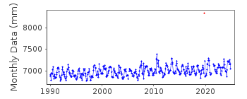
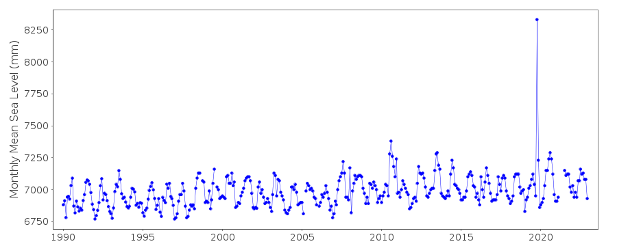
There is what appears to be substantial rise in the plot for Xi Sha for theperiod Jul-Dec 2010. Although the data has been 'buddy checked' with other
neighbouring stations because of its relatively remote position it is difficult
to establish when the phenomenon is real or not.
Data Authority
National Marine Data and Information Service (NMDIS)No. 93 Liuwei Road
Tianjin 300171

![]()
![]()
![]()
