Data
- Obtaining
- Supplying
- High-Frequency
- Bottom Pressure Records
- Other Long Records
- GLOSS/ODINAFRICA Calibration Data
Donate
Donate to PSMSL
Data Notes
- Individual Station Data and Plot Notes
- Referencing the Data Set
- PSMSL Help File
- 2010 Changes to the PSMSL Data Files
Extracted from Database
20 Jul 2026
Station Information
| Station ID: | 1705 |
| Latitude: | 18.383333 |
| Longitude: | 122.1 |
| Coastline code: | 660 |
| Station code: | 3 |
| Country: | PHILIPPINES |
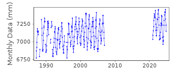
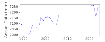
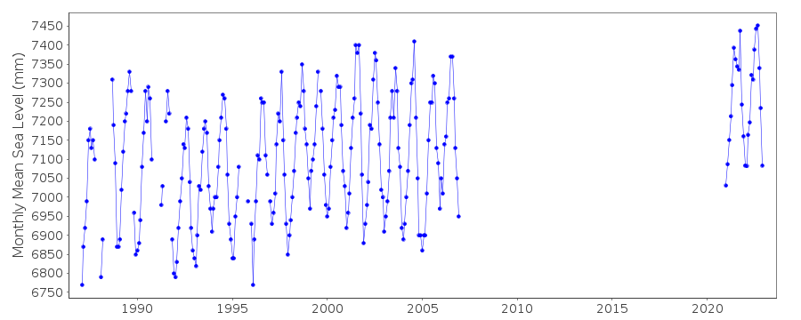
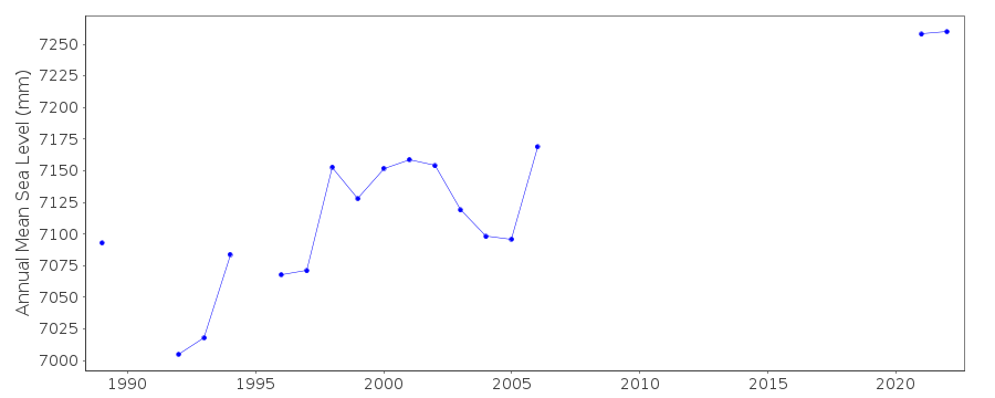
| Time span of data: | 1987 – 2025 |
| Completeness (%): | 59 |
| Date of last update: | 08 Jul 2026 |
| Green Arrow: | Current Station |
| Yellow Marker: | Neighbouring RLR Station |
| Red Marker: | Neighbouring Metric Station |
Please note: In many cases, the station position in our database is accurate to only one minute. Thus, the tide gauge may not appear to be on the coast.
Tide Gauge Data
Station Documentation
Link to RLR information.Documentation added 1993-07-12
Port Irene 660/003 RLR(1992) is 10.6m below BM 1Documentation added 1999-03-30
gauge type = OttDocumentation added 2009-10-20
2006 is the last data received from Port Irene as thetide gauge has been removed due to development of the pier.
A replacement gauge has been established at San Vicente.
Data Authority
National Mapping and Resource Information AuthorityHydrography Department
421 Barraca St,
San Nicolas 1010
Manila

![]()
![]()
![]()
