Data
- Obtaining
- Supplying
- High-Frequency
- Bottom Pressure Records
- Other Long Records
- GLOSS/ODINAFRICA Calibration Data
Donate
Donate to PSMSL
Data Notes
- Individual Station Data and Plot Notes
- Referencing the Data Set
- PSMSL Help File
- 2010 Changes to the PSMSL Data Files
Extracted from Database
20 Jul 2026
Station Information
| Station ID: | 1703 |
| Latitude: | 6.226389 |
| Longitude: | 102.106667 |
| Coastline code: | 550 |
| Station code: | 21 |
| Country: | MALAYSIA |
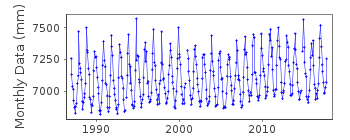
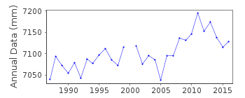
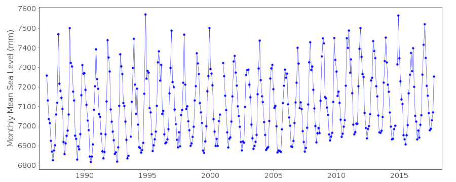
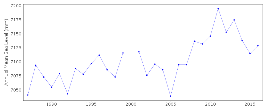
| Time span of data: | 1987 – 2017 |
| Completeness (%): | 98 |
| Link to ellipsoid: | Available |
| Date of last update: | 09 Jul 2019 |
| Green Arrow: | Current Station |
| Yellow Marker: | Neighbouring RLR Station |
| Red Marker: | Neighbouring Metric Station |
Please note: In many cases, the station position in our database is accurate to only one minute. Thus, the tide gauge may not appear to be on the coast.
Tide Gauge Data
Additional Data Sources (guide to additional data sources)
Nearby GNSS Stations from SONEL: GETIResearch Quality Data from UHSLC station 326: hourly and daily
Station Documentation
Link to RLR information.Documentation added 1993-07-12
Geting 550/021 RLR(1987) is 10.8m below BM D 0353Documentation added 1997-03-20
december and annual means for 1990 revised March 1997Documentation added 2012-09-17
From Malaysian publication Tidal Observation Records 2010 the Primarybenchmark is BM D0354 5.964m above gauge datum. Orignal value for the
benchmark/datum relationship was 5.966m. There is a comment on the old
RLR diagram from September 1999 that BM D0354 is 5.964m relative to TGZ.
The RLR factor has now been changed to 4.789m and the data amended.
Data Authority
Department of Survey and MappingWisma JUPEM
Jalan Semarak
50578 Kuala Lumpur

![]()
![]()
![]()
