Data
- Obtaining
- Supplying
- High-Frequency
- Bottom Pressure Records
- Other Long Records
- GLOSS/ODINAFRICA Calibration Data
Donate
Donate to PSMSL
Data Notes
- Individual Station Data and Plot Notes
- Referencing the Data Set
- PSMSL Help File
- 2010 Changes to the PSMSL Data Files
Extracted from Database
13 Jul 2026
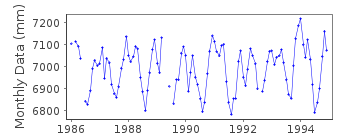
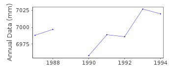
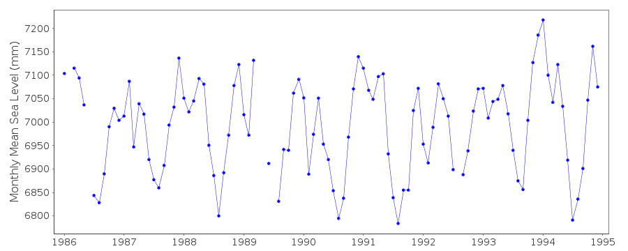
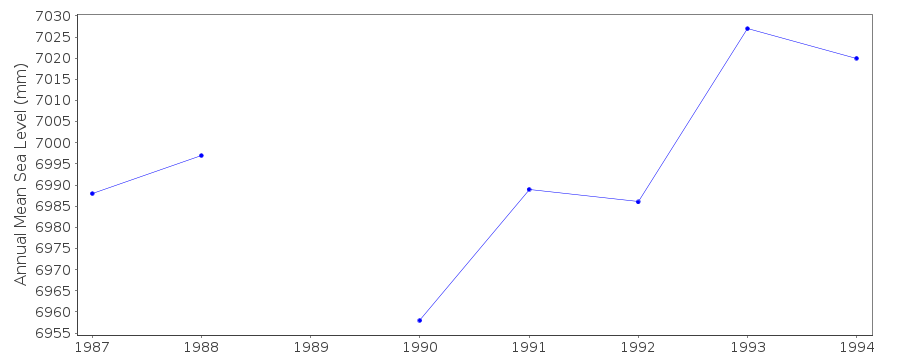
Station Information
| Station ID: | 1690 |
| Latitude: | 19.633333 |
| Longitude: | 37.116667 |
| Coastline code: | 477 |
| Station code: | 1 |
| Country: | SUDAN |
| Time span of data: | 1986 – 1994 |
| Completeness (%): | 94 |
| Date of last update: | 27 Feb 1995 |
| Green Arrow: | Current Station |
| Yellow Marker: | Neighbouring RLR Station |
| Red Marker: | Neighbouring Metric Station |
Please note: In many cases, the station position in our database is accurate to only one minute. Thus, the tide gauge may not appear to be on the coast.
Tide Gauge Data
Station Documentation
Link to RLR information.Documentation added 2000-06-28
Port Sudan 477/001 RLR(1994) is 8.8m below BM 11158Port Sudan is an historic station last data 1994
Data Authority
Faculty of Marine Sciences and FisheriesRed Sea University
P.O. Box 24
Port Sudan

![]()
![]()
![]()
