Data
- Obtaining
- Supplying
- High-Frequency
- Bottom Pressure Records
- Other Long Records
- GLOSS/ODINAFRICA Calibration Data
Donate
Donate to PSMSL
Data Notes
- Individual Station Data and Plot Notes
- Referencing the Data Set
- PSMSL Help File
- 2010 Changes to the PSMSL Data Files
Extracted from Database
20 Jul 2026
Station Information
| Station ID: | 1604 |
| Latitude: | 37.979583 |
| Longitude: | 23.541694 |
| Coastline code: | 290 |
| Station code: | 30 |
| Country: | GREECE |
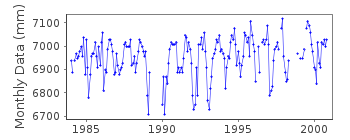
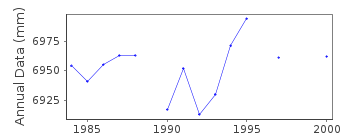
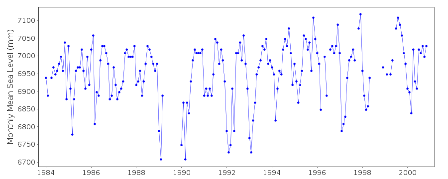
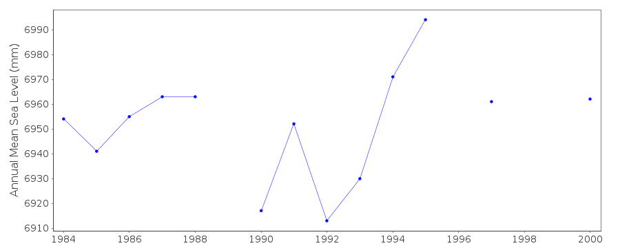
| Time span of data: | 1984 – 2000 |
| Completeness (%): | 89 |
| Date of last update: | 07 Aug 2013 |
| Green Arrow: | Current Station |
| Yellow Marker: | Neighbouring RLR Station |
| Red Marker: | Neighbouring Metric Station |
Please note: In many cases, the station position in our database is accurate to only one minute. Thus, the tide gauge may not appear to be on the coast.
Tide Gauge Data
Additional Data Sources (guide to additional data sources)
Nearby Real Time Stations from VLIZ: peirStation Documentation
Link to RLR information.Documentation added 2000-04-25
North Salaminos 290/030 RLR(1988) is 8.5m below BM R114Documentation added 2011-02-15
Last data from this tide gauge was for 2000. After this the gauge wasre-located to new site 37 59'N 23 32'E. Although one of the benchmarks remains
R 114 it was decided to enter the new data as a separate station. North
Salaminos II id.1938.
Documentation added 2013-08-07
Following receipt of datum diagrams from the Hellenic Navy the RLR diagran has been re-drawn. In consequence the RLR factor has changed.Data Authority
Hellenic Navy Hydrographic ServiceGeographic Policy and International Relations Office
TGN 1040
Athens

![]()
![]()
![]()
