Data
- Obtaining
- Supplying
- High-Frequency
- Bottom Pressure Records
- Other Long Records
- GLOSS/ODINAFRICA Calibration Data
Donate
Donate to PSMSL
Data Notes
- Individual Station Data and Plot Notes
- Referencing the Data Set
- PSMSL Help File
- 2010 Changes to the PSMSL Data Files
Extracted from Database
13 Jul 2026
Station Information
| Station ID: | 1567 |
| Latitude: | 33.499167 |
| Longitude: | 133.569167 |
| Coastline code: | 644 |
| Station code: | 5 |
| Country: | JAPAN |
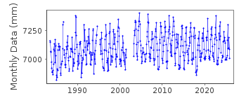
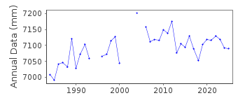
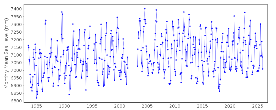
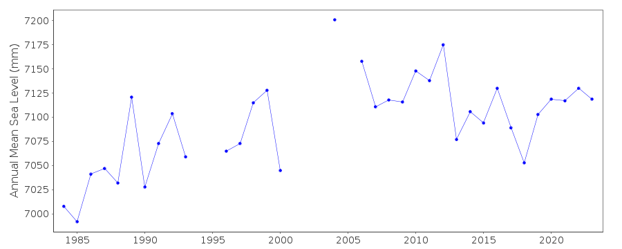
| Time span of data: | 1983 – 2025 |
| Completeness (%): | 92 |
| Date of last update: | 08 Apr 2026 |
| Green Arrow: | Current Station |
| Yellow Marker: | Neighbouring RLR Station |
| Red Marker: | Neighbouring Metric Station |
Please note: In many cases, the station position in our database is accurate to only one minute. Thus, the tide gauge may not appear to be on the coast.
Tide Gauge Data
Station Documentation
Link to RLR information.Documentation added 2003-11-17
This data was formerly under KOCHI II (644/002). The station was replaced in 1983 after 2 years without data. Although the datum information seems to show continuity with KOCHI II (linked through Tokyo Peil), the time-series clearly shows a datum shift and so has been moved to a new time-series.Documentation added 2009-05-05
Seems to be a slight rise in the dataset after the gap in 2001-2002.Documentation added 2012-02-22
A massive earthquake magnitude 9.0 occurred at 14.46 JST (05.46 UTC) on Friday 11th March 2011 with the epicentre situated approx. 70km east of the Oshika Peninsula of Tohoku. It was the largest earthquake to strike Japan triggering a tsunami with waves of up to 40.5m high and travelling inland up to 10km.Data Authority
Japan Meteorological Agency3-6-9 Toranomon, Minato City
Tokyo

![]()
![]()
![]()
