Data
- Obtaining
- Supplying
- High-Frequency
- Bottom Pressure Records
- Other Long Records
- GLOSS/ODINAFRICA Calibration Data
Donate
Donate to PSMSL
Data Notes
- Individual Station Data and Plot Notes
- Referencing the Data Set
- PSMSL Help File
- 2010 Changes to the PSMSL Data Files
Extracted from Database
20 Jul 2026
Station Information
| Station ID: | 1526 |
| Latitude: | 55.989833 |
| Longitude: | -3.181694 |
| Coastline code: | 170 |
| Station code: | 32 |
| Country: | UNITED KINGDOM |
| Time span of RLR data: | 1989 – 2025 |
| RLR completeness (%): | 83 |
| Time span of metric data: | 1981 – 2025 |
| Metric completeness (%): | 70 |
| Date of last update: | 19 Feb 2026 |
| Green Arrow: | Current Station |
| Yellow Marker: | Neighbouring RLR Station |
| Red Marker: | Neighbouring Metric Station |
Please note: In many cases, the station position in our database is accurate to only one minute. Thus, the tide gauge may not appear to be on the coast.
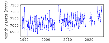
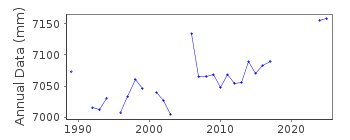
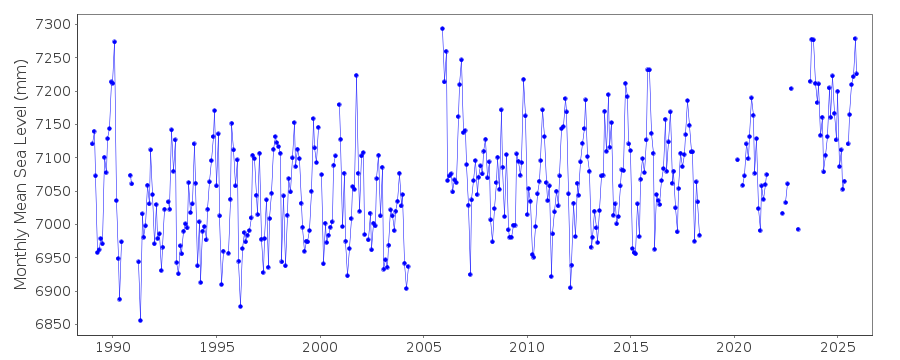
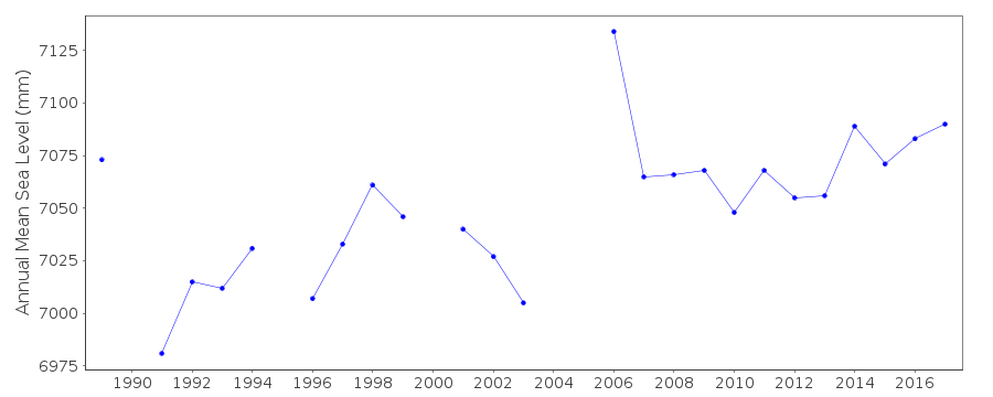
Tide Gauge Data
Additional Data Sources (guide to additional data sources)
Nearby GNSS Stations from SONEL: EDINNearby Real Time Stations from VLIZ: leit
Station Documentation
Link to RLR information.Documentation added 1993-07-12
Leith II 170/032 RLR(1991) is 11.7m below TGBMDocumentation added 1994-07-21
See Leith (170/031) for details of gauges employed at Leith.Documentation added 2001-01-02
Recent work on vertical land movements in the UK can be found fromthe University of Nottingham web site:
http://ukcogr.iessg.nottingham.ac.uk/~eosi/
Documentation added 2006-11-15
Historic tide gauge information: Dataring installed in November 1988.February 2002 new data logger fitted. This logger gave incorrect
density and gravity readings.
Tide gauge building was burned down in 2004.
Documentation added 2009-01-28
Treat as suspect 2006 data onwards.Documentation added 2014-07-03
Two site visite were carried out during 2013. 26.02.2013 for general maintenance and again in 02.05.2013 again for general maintenance and change the compressor.Documentation added 2015-06-02
TGI were at site on 10.10.14 for general maintenance and to change the compressor.Data Authority
Environment AgencyHorizon House
Deanery Road
BS1 5AH
Bristol

![]()
![]()
![]()
