Data
- Obtaining
- Supplying
- High-Frequency
- Bottom Pressure Records
- Other Long Records
- GLOSS/ODINAFRICA Calibration Data
Donate
Donate to PSMSL
Data Notes
- Individual Station Data and Plot Notes
- Referencing the Data Set
- PSMSL Help File
- 2010 Changes to the PSMSL Data Files
Extracted from Database
13 Jul 2026
Station Information
| Station ID: | 1451 |
| Latitude: | 21.783333 |
| Longitude: | 89.466667 |
| Coastline code: | 510 |
| Station code: | 3 |
| Country: | BANGLADESH |
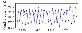
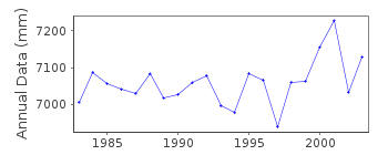
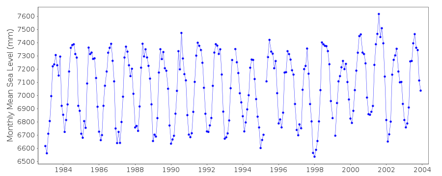
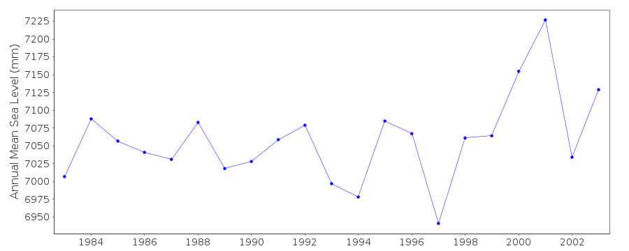
| Time span of RLR data: | 1983 – 2003 |
| RLR completeness (%): | 99 |
| Time span of metric data: | 1977 – 2003 |
| Metric completeness (%): | 98 |
| Date of last update: | 08 Jun 2005 |
| Green Arrow: | Current Station |
| Yellow Marker: | Neighbouring RLR Station |
| Red Marker: | Neighbouring Metric Station |
Please note: In many cases, the station position in our database is accurate to only one minute. Thus, the tide gauge may not appear to be on the coast.
Tide Gauge Data
Additional Data Sources (guide to additional data sources)
Research Quality Data from UHSLC station 134: hourly and dailyStation Documentation
Link to RLR information.Documentation added 1993-11-15
DATA RECEIVED FROM TOGA OFFICEDocumentation added 1996-10-15
instrument type: float and well type gauge (Munro)Data Authority
Bangladesh Inland Water, Department of HydrographyTransport Authority
141-143 Motijheel C/a
Dhaka 1000

![]()
![]()
![]()
