Data
- Obtaining
- Supplying
- High-Frequency
- Bottom Pressure Records
- Other Long Records
- GLOSS/ODINAFRICA Calibration Data
Donate
Donate to PSMSL
Data Notes
- Individual Station Data and Plot Notes
- Referencing the Data Set
- PSMSL Help File
- 2010 Changes to the PSMSL Data Files
Extracted from Database
20 Jul 2026
Station Information
| Station ID: | 1262 |
| Latitude: | 41.616667 |
| Longitude: | 15.916667 |
| Coastline code: | 270 |
| Station code: | 19 |
| Country: | ITALY |
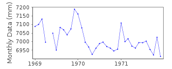
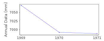
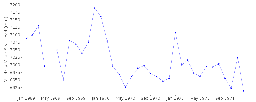
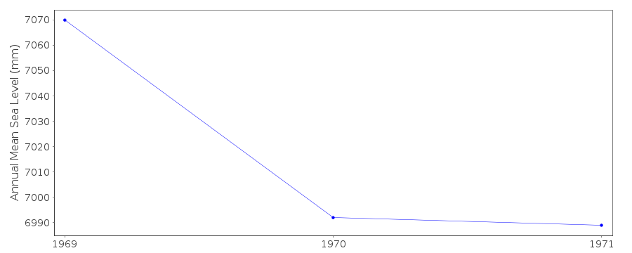
| Time span of data: | 1969 – 1971 |
| Completeness (%): | 97 |
| Date of last update: | 01 Jan 1980 |
| Green Arrow: | Current Station |
| Yellow Marker: | Neighbouring RLR Station |
| Red Marker: | Neighbouring Metric Station |
Please note: In many cases, the station position in our database is accurate to only one minute. Thus, the tide gauge may not appear to be on the coast.
Tide Gauge Data
Station Documentation
Link to RLR information.Documentation - date unknown
NO BM INFORMATION BUT DATA SEEMS HOMOGENEOUSDocumentation added 1991-06-11
Manfredonia 270/019 RLR(1971) is 8.9m below BMDocumentation added 1993-07-12
Manfredonia 270/019 RLR(1971) is 8.9m below BMManfredonia is an historic station last data 1971
Data Authority
CNR - Istituto di Scienze MarineAREA Science Park
Basovizza
I-34149 Trieste
Documentation added 2008-10-31
This authority was formerly called the Istituto Talassograficodi Trieste.

![]()
![]()
![]()
