Data
- Obtaining
- Supplying
- High-Frequency
- Bottom Pressure Records
- Other Long Records
- GLOSS/ODINAFRICA Calibration Data
Donate
Donate to PSMSL
Data Notes
- Individual Station Data and Plot Notes
- Referencing the Data Set
- PSMSL Help File
- 2010 Changes to the PSMSL Data Files
Extracted from Database
13 Jul 2026
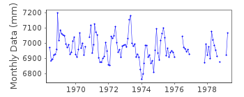
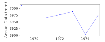
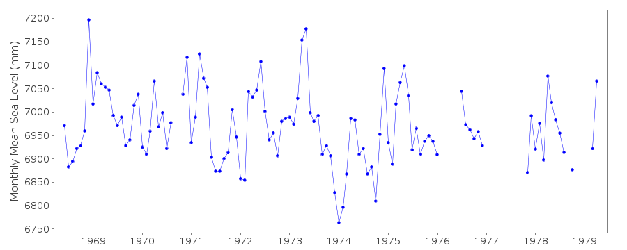
Station Information
| Station ID: | 1223 |
| Latitude: | 47.216667 |
| Longitude: | -70.283333 |
| Coastline code: | 970 |
| Station code: | 66 |
| Country: | CANADA |
| Time span of data: | 1968 – 1979 |
| Completeness (%): | 76 |
| Date of last update: | 01 Jan 1980 |
| Green Arrow: | Current Station |
| Yellow Marker: | Neighbouring RLR Station |
| Red Marker: | Neighbouring Metric Station |
Please note: In many cases, the station position in our database is accurate to only one minute. Thus, the tide gauge may not appear to be on the coast.
Tide Gauge Data
Station Documentation
Link to RLR information.Documentation added 1991-06-11
St Jean-Port-Joli 970/066 RLR(1973) is 21.8m below BM CLXXVIIDocumentation added 2010-08-19
Primary benchmark 1968-1978 is BM CLXXVII. Primary benchmark 1979 onwards BM POJO-2-1967. This does not alter the RLR factor of 6.770m. Last data April 1979.Data Authority
Canadian Hydrographic Service615 Booth Street
Ottawa
Ontario K1A 0E6

![]()
![]()
![]()
